After spending close to a month in Utah making our way to The Mighty Five, we traveled through the Mojave Desert, stopping one night in Barstow, CA, before arriving in Twentynine Palms. From here, we would spend the next day and a half exploring Joshua Tree National Park.
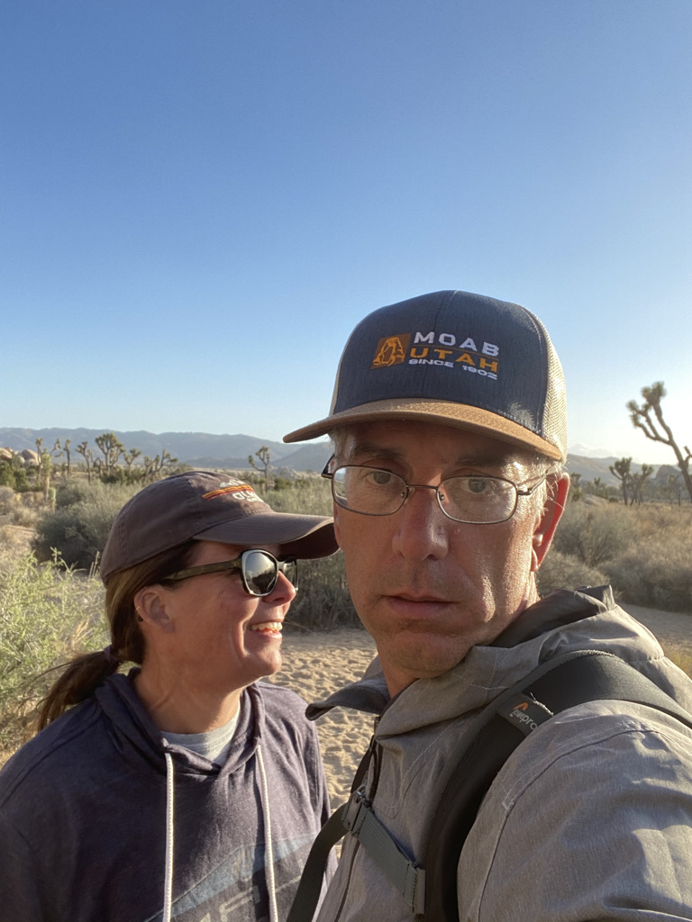
We had just set up camp and it was early afternoon. The sun was out, and the temperature was a perfect 75 degrees! With no time to waste, we packed our gear and made our way to Joshua Tree National Park. Our goal for the day was to take in as many sites as possible before the sun went down.
Before heading into the park we stopped at a gas station to fill up. This is a big park, 794,000 acres. I wanted a full tank of gas as we were unsure how much territory we would be covering on our first day. In addition, there is no cell phone coverage in the park. If we ran out of gas there would be no way to call for assistance, I was taking no chances.
The easiest way to navigate the park is to take Park Boulevard which connects the West and North Entrances. Another entrance, at the Cottonwood Visitor Center, is located in the southern section of the park off Interstate 10. From our location, one would take Pinto Basin Road to reach this entrance. As most of the sites are located in the northern section of the park, we would not drive the 38 miles to the south entrance. Instead, we would take Pinto Basin Road as far as the Ocotillo Patch before turning around.

An interesting fact about Joshua Tree National Park is the Mojave Desert makes up the western half of the park. The elevation for this section starts at 3,000 feet. The eastern section of the park is where the Colorado Desert begins and the elevation drops below 3,000 feet.
Before going anywhere in the park, our usual first stop would be the Visitor Center to pick up a park map. We reviewed the map, made a tentative agenda, and started out along Park Boulevard.
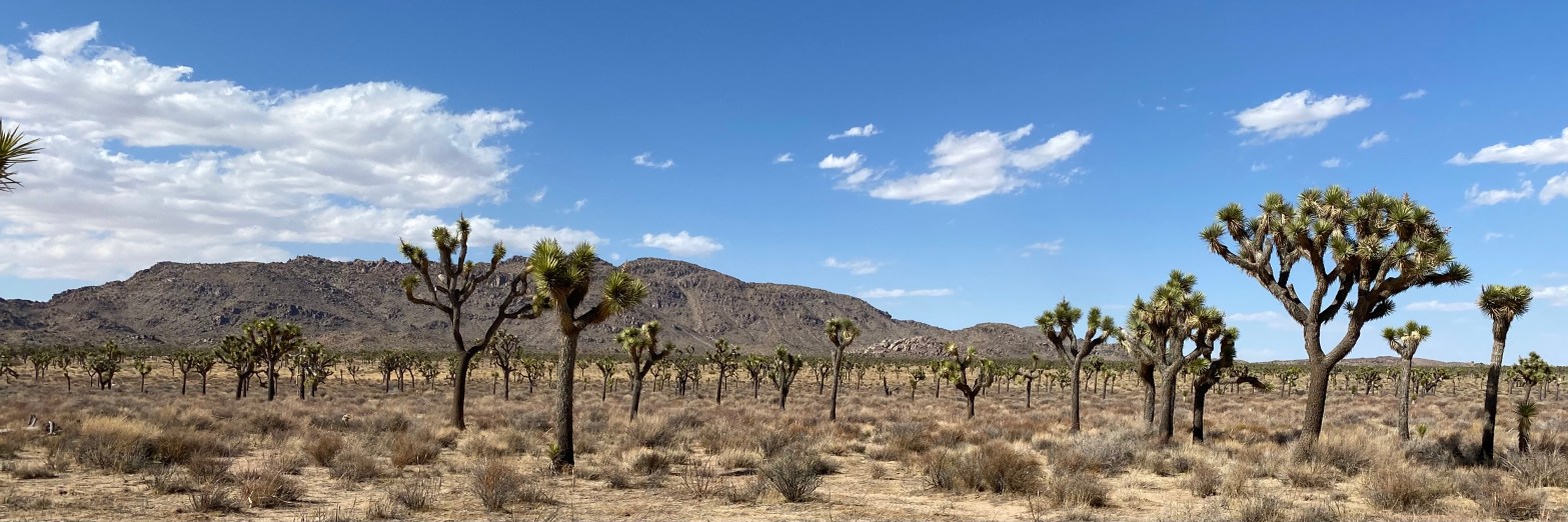
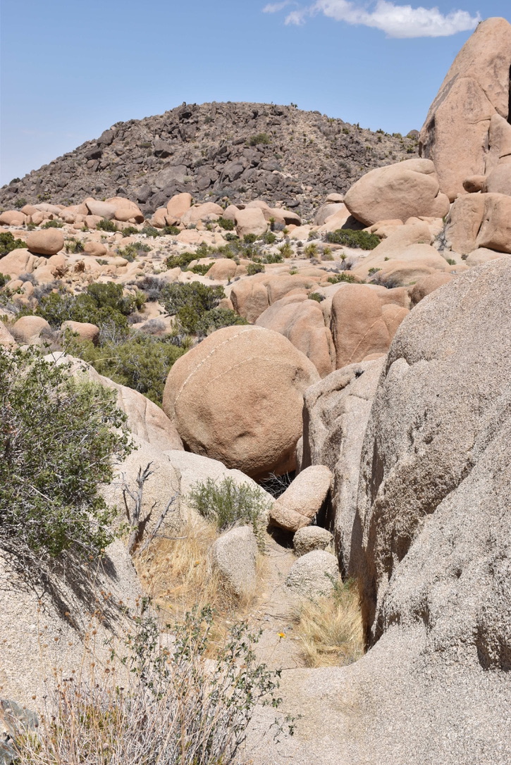
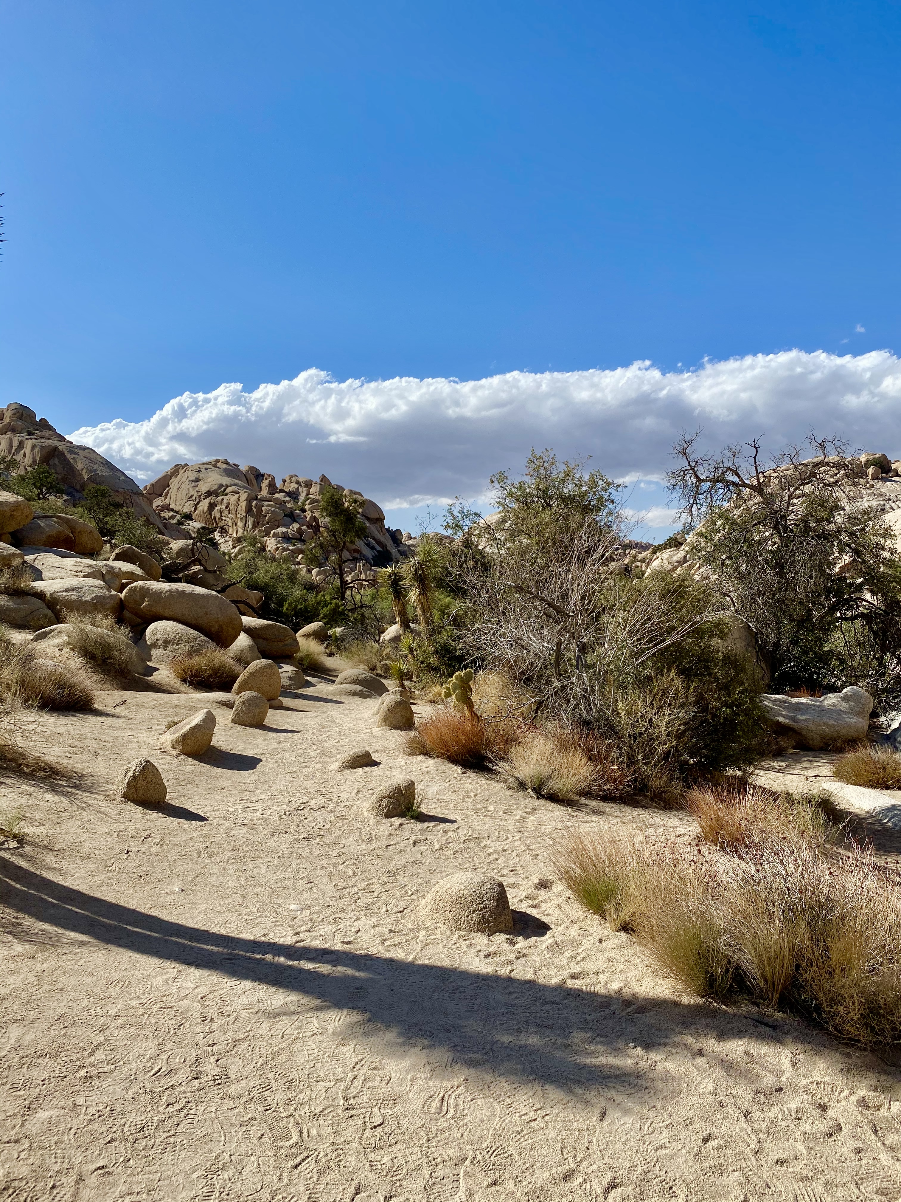
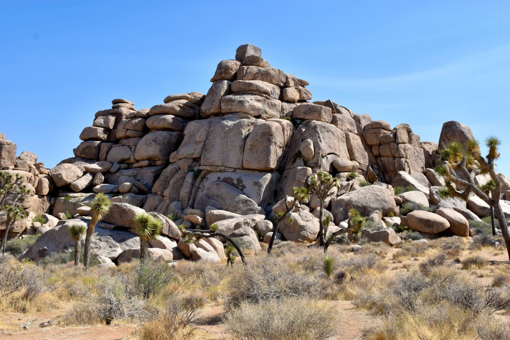
All the hikes we would attempt for our first day would be off Park Boulevard. As we drove into the park, I gasped at the views as they were dramatically different from those we had experienced in Utah. The red sand was now lighter beige sand. Dramatic canyon views were replaced by boulder heaves randomly scattered throughout the desert. Here, where the Mojave and Colorado desert meet, the landscape and vegetation provided new and unusual sights. It would certainly be a different experience.
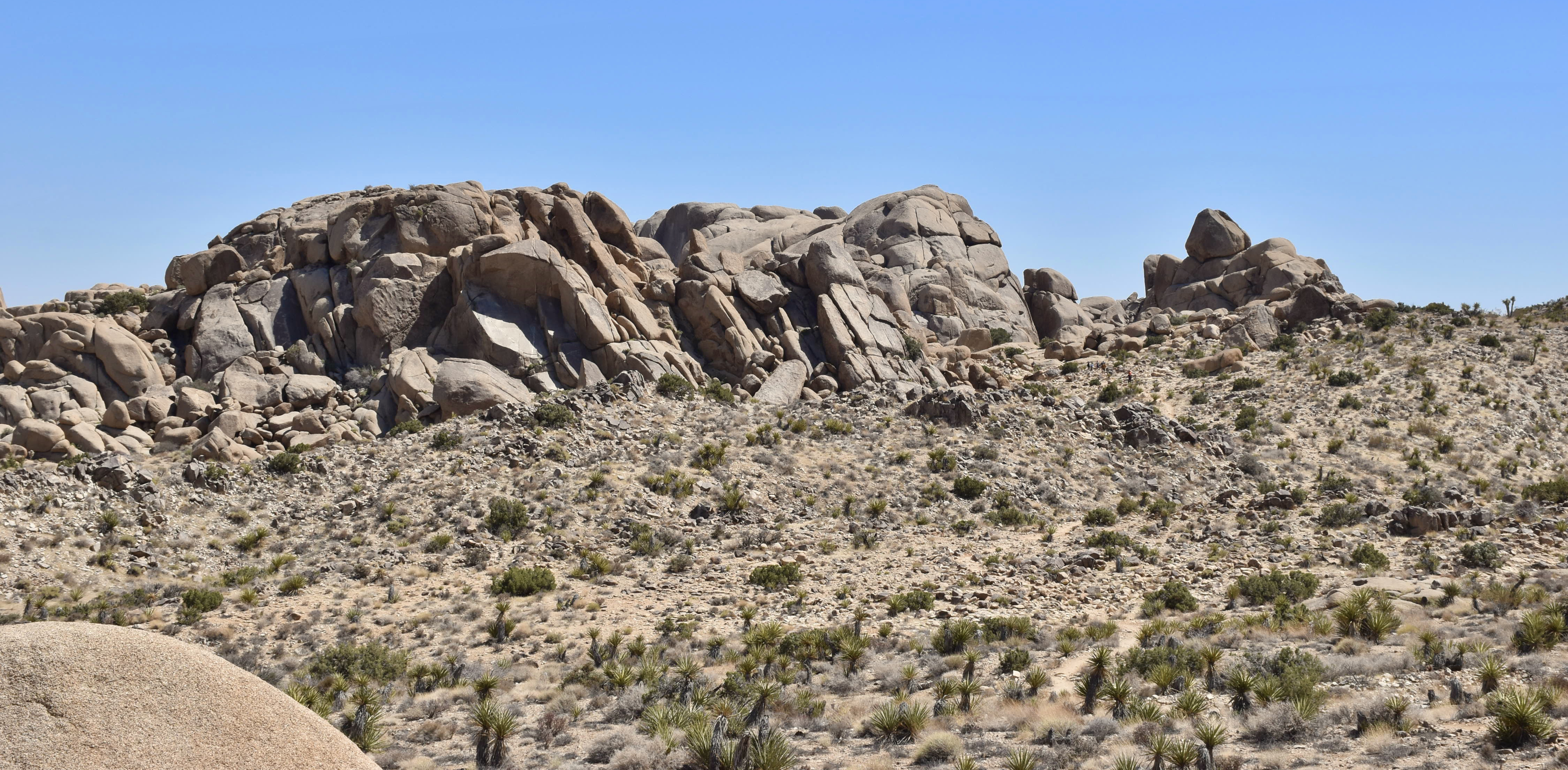
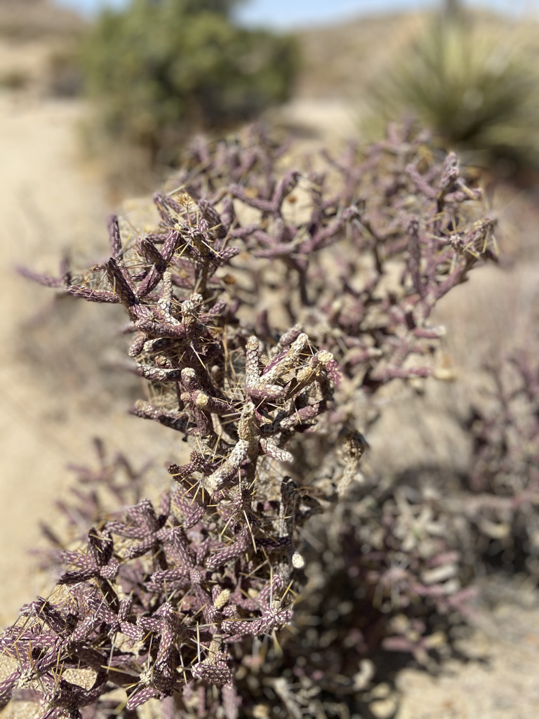
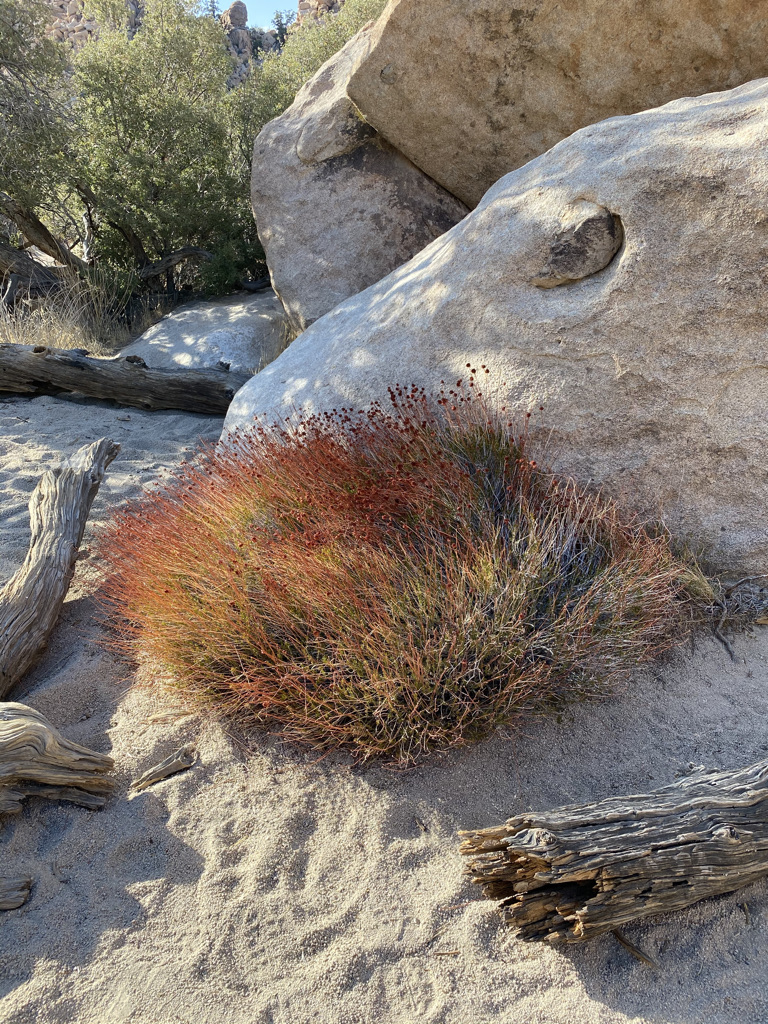
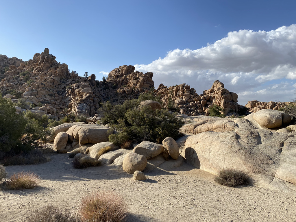
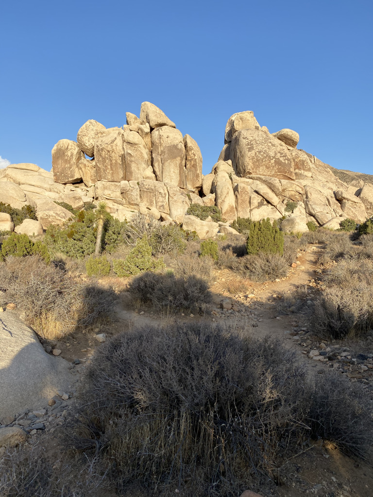
Our first stop would be Split Rock, a 1.9-mile loop trail. The parking area sits in the middle of a boulder heave. The trail leads you through the boulders and into the desert. Along the trail, you will find many unusual looking cactus. Make sure you watch your step, you do not want to brush up against these as you are hiking! As for the boulder heaves, they were plentiful. All I could do was scratch my head in bewilderment, where did the boulders come from?


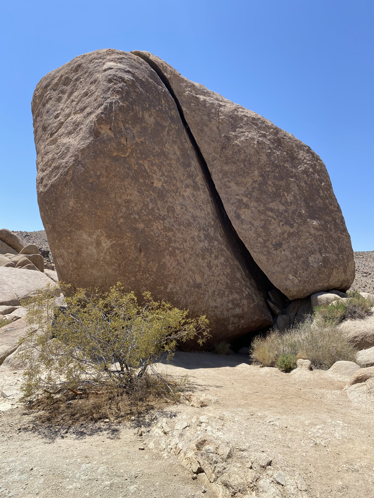

The rock formation and vegetation along this trail are pretty amazing and one can freely roam among the rock formations. The boulder formations leave you wondering how this is possible. To understand the process, check out this video.
A word of caution. I strongly suggest having a downloadable trail map from Alltrails. We actually had to rely on this app to find our way back to the parking lot as the trail is not marked well. There are a couple of trails off the loop trail and dry water washes can be mistaken for a trail. During our hike, we came across a couple who asked if they could follow us out. They said they got turned around and could not find their way back to the parking lot. We told them we were also having some difficulty and we were using the app to help guide us back to the parking lot.
Our next stop would be Skull Rock off Park Boulevard. You can not miss it. As you approach, you will find cars parked on the edge of the road and people wandering in the middle of the road. It is a popular stop. The rock formation looked like a great place to explore and climb, as noted by the number of people scrambling up and down the various rock formations.
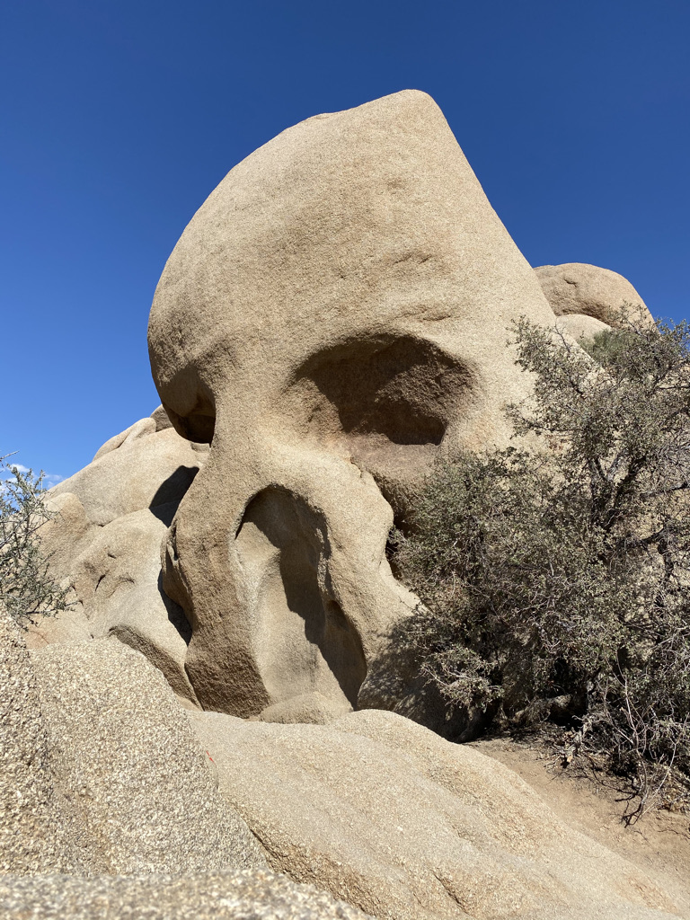
We did not hang out here for long as it was pretty crowded. We took our picture of 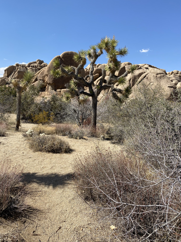 Skull Rock and crossed the road to explore the Skull Rock Discovery Trail, a 0.7-mile Loop Trail. Face Rock Trail, a spur trail, can be taken off this loop. This trail leads to Split Rock Trail, where we had just left. If you choose to hike to Face Rock Trail consider starting at Split Rock. There is more parking and it might not be as crowded.
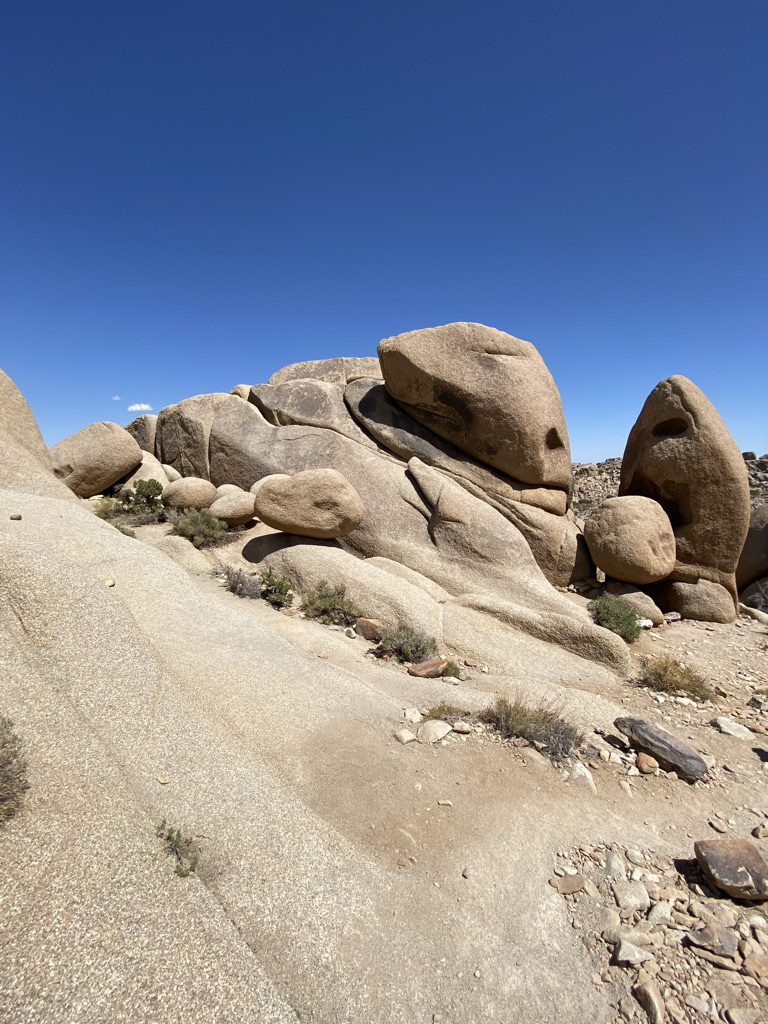
We didn’t make it to Face Rock, or did we? We came across several rocks that could be considered faces, my wife has a pretty good imagination. Here are some examples. Let me know if you agree.

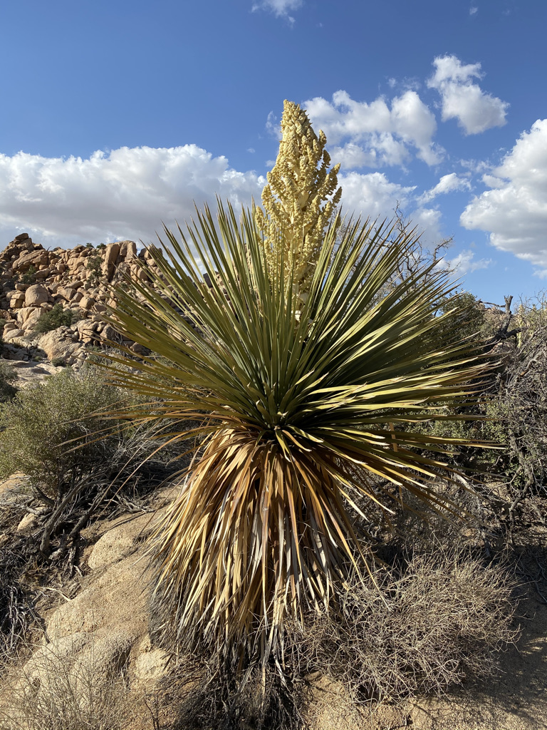
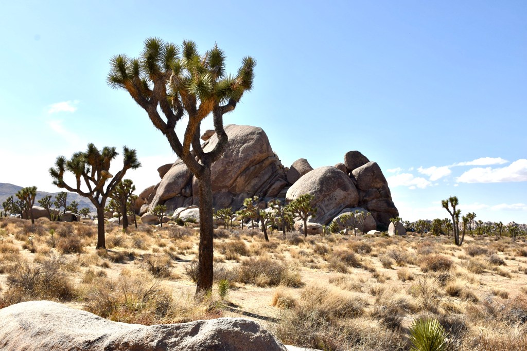
We continued on Park Boulevard and approached a sign for Big Horn Pass Road and decided to take it. The paved road immediately turned into a dirt road. This was a nice break from all the crowds as no one was on this road. It was along this road where we found ourselves surrounded by Joshua Trees. We made a great choice, stopping several times to take pictures of the Joshua Trees.

The road merged into Queen Valley Rd and led to Barker Dam Road. The 3-mile excursion offered a brief adventure away from the crowds and provided another opportunity to travel off the beaten path, one of the goals of this three-month trip.
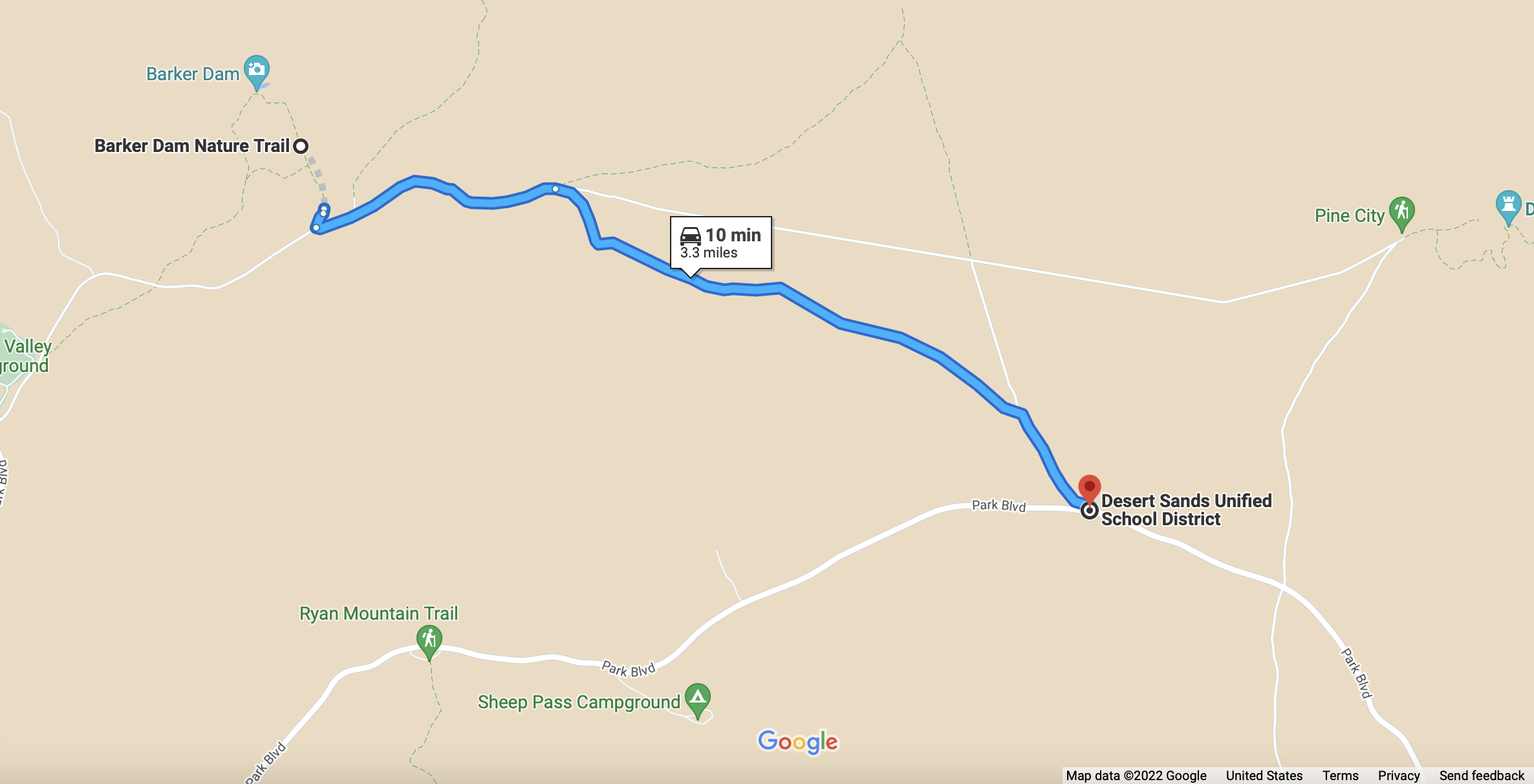
We were now at the Barker Dam Trailhead, so we parked and hiked the 1.1-mile Barker Dam Nature Trail loop. The trail, as the name implies, leads to a dam built by cattlemen in 1900 for watering their livestock. The dam is not an awe-striking site, and do not expect much water. Rather, it is a place to take a moment and think about the history and purpose of the dam. The dam is listed in the National Register of Historic Places, making it worth the time due to its historic listing. I found myself thinking about how hard life must have been in this area as I took in the arid landscape.

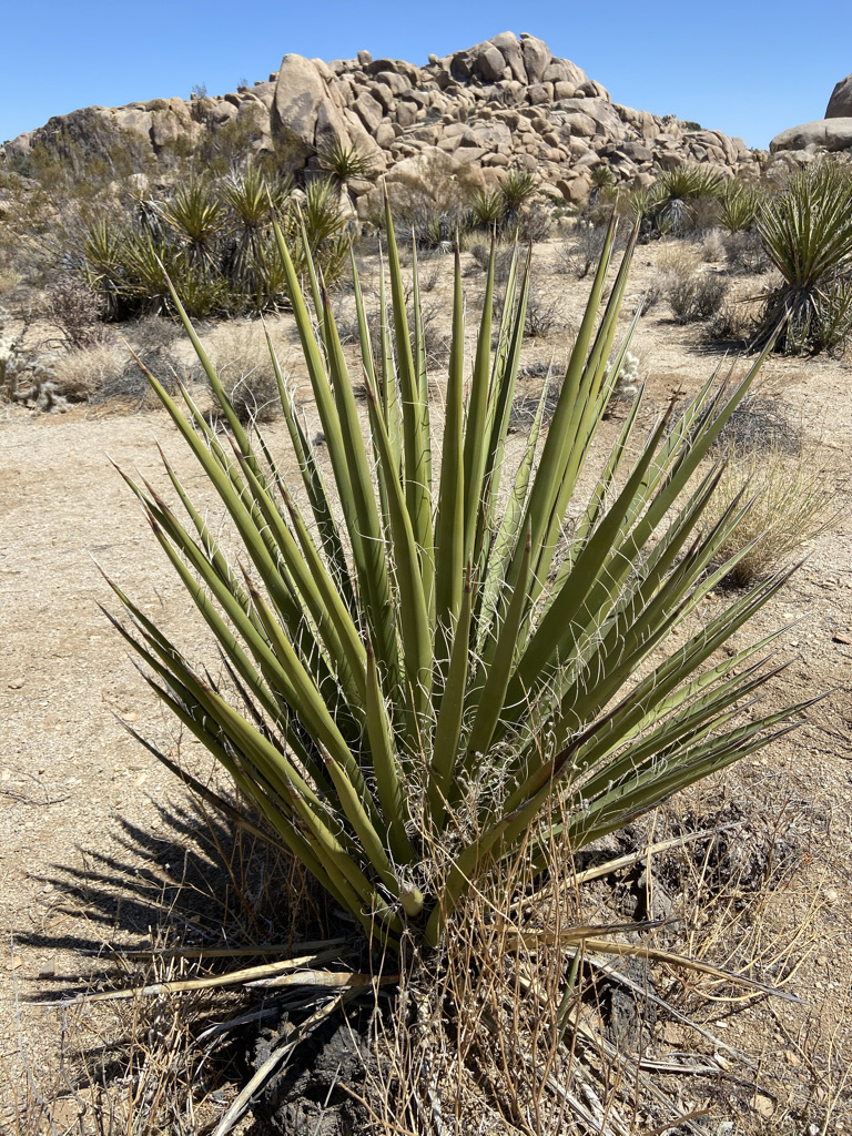
The next stop would be Hidden Valley Nature Trail, a 1.0-mile loop trail. The desert plants on this trail provide great photo opportunities. If I recall correctly, the further we hiked along the loop, the easier it was to get turned around and off-trail. I consider myself pretty confident when it comes to my sense of direction. However, out in this desert, it was pretty scary and eye opening how easy one can lose their sense of direction. Alltrails came to our rescue once again by keeping us on track.

As the sun was setting, we would make our final hike to the Hall of Horrors. For some reason, I was not looking forward to this hike, but it was on our list. My wife told me there were halls or slots to explore among the boulders. I thought to myself, great, where does horror come into play?
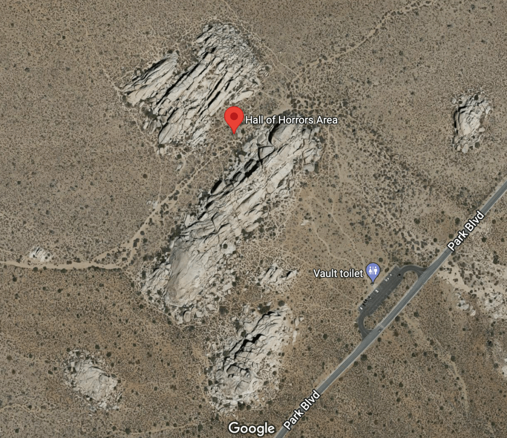
From the parking lot, we could see a pile of boulders. A loop trail leads around the massive boulder pile. Somewhere along this loop trail was a “secret” trail that leads into the boulders. This trail leads to the hidden “Hall of Horrors”. As I stayed on the trail, my wife would step off the trail while attempting to find a secret trail. Her attempts were unsuccessful.
We made our way around the loop and back to the parking lot. She was a little disappointed. I was happy to be alive. If you come here looking for this trail, do your research. Hopefully, you will find the exact location of the Hall of Horrors. Good Luck!
We left the park excited for all we had accomplished in half a day. It was time to head back to camp.
The next day we woke to cool morning temperatures, 50 degrees. It was late May, and daytime temperatures for this time of year can easily reach 90 degrees. Today, the forecast called for a high of 75 degrees. We were pleasantly surprised and enjoyed every minute of the cooler temperatures.
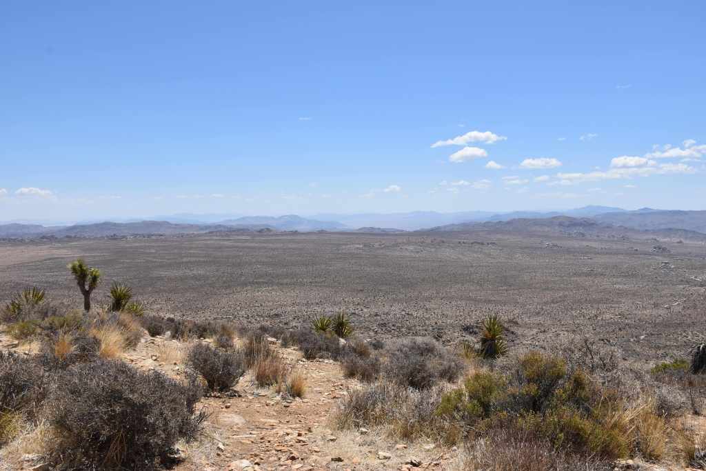
Our first hike of the day would be Ryan Mountain. As this trail is one of the most popular trails in the park, it is necessary to arrive early, as parking fills quickly. The 3.0-mile out and back trail climbs 1,000 feet in elevation. It is considered a moderate trail and as always, come prepared. The summit provided stunning views of the park. You will enjoy views of the desert valley below and mountains in the far distance with cactus and Joshua Trees around us. What a beautiful sight! After a short rest, we made out way back down the mountain and to our truck.
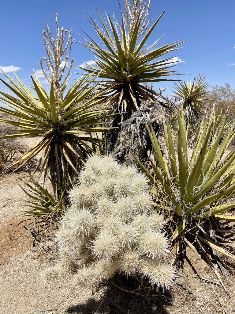
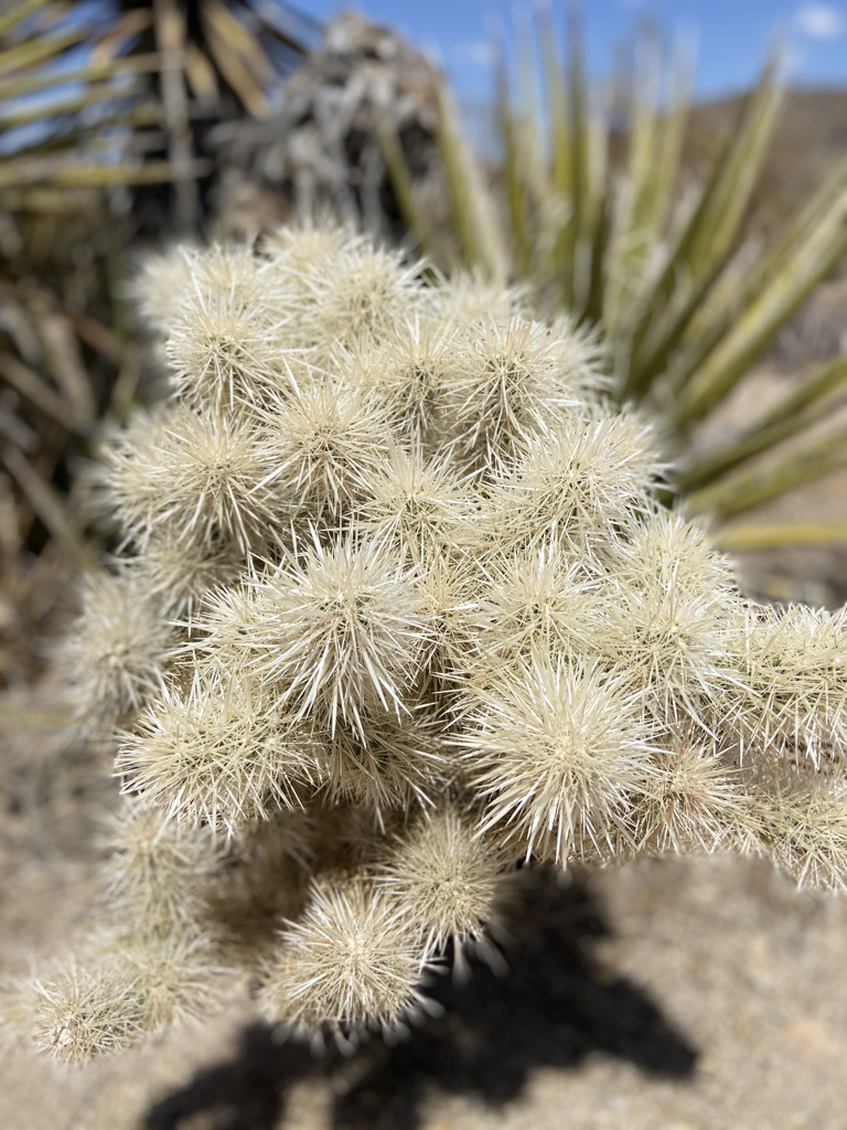
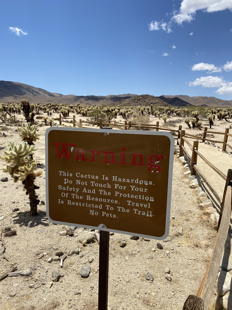
It was time to travel down Pinto Basin Road to check out the Cholla Cactus Garden. As we approached the Cholla Cactus Garden we began to see thousands of Cholla Cactus on both sides of the road. It was quite an unusual sight that only pictures can describe. A trail leads through this garden of cactus, and a lone sign warning not to touch. As comedian Bill Engvall would say, “Here’s Your Sign”. This is truly an incredible display of this singular cacti.
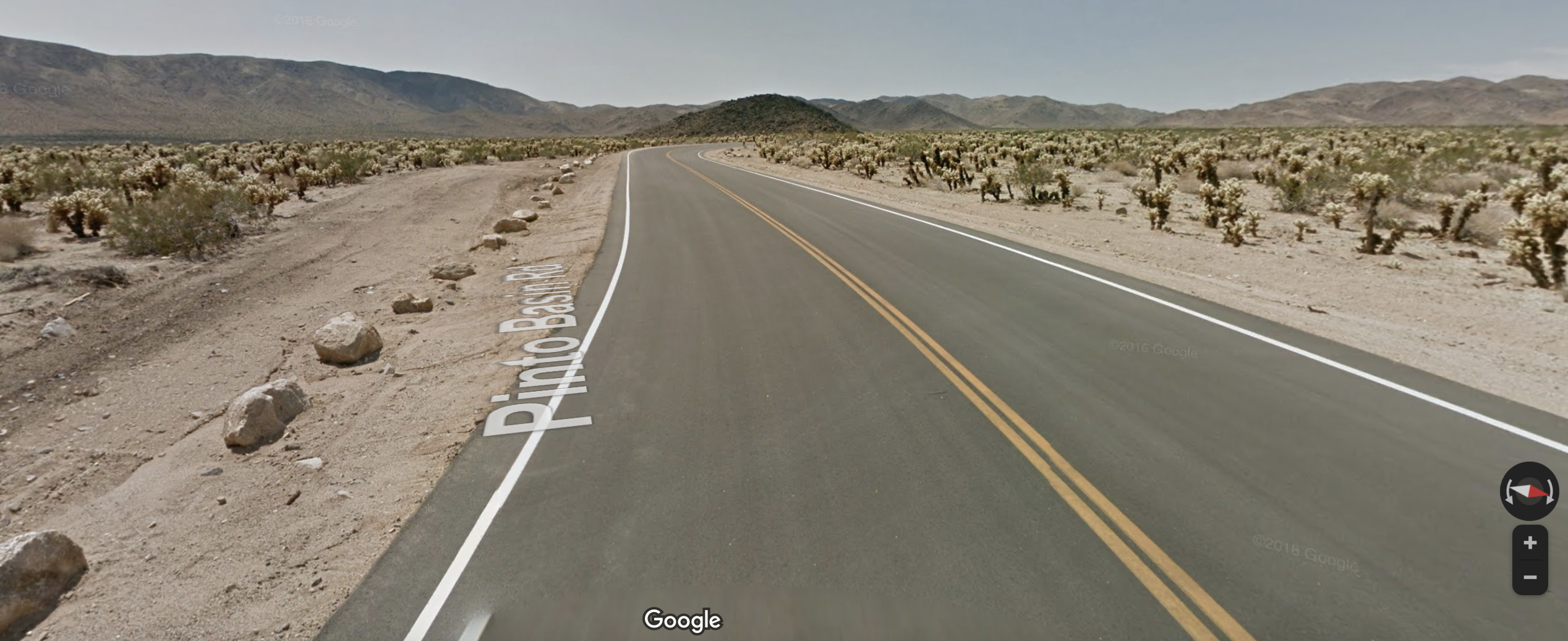

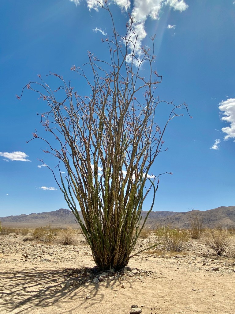
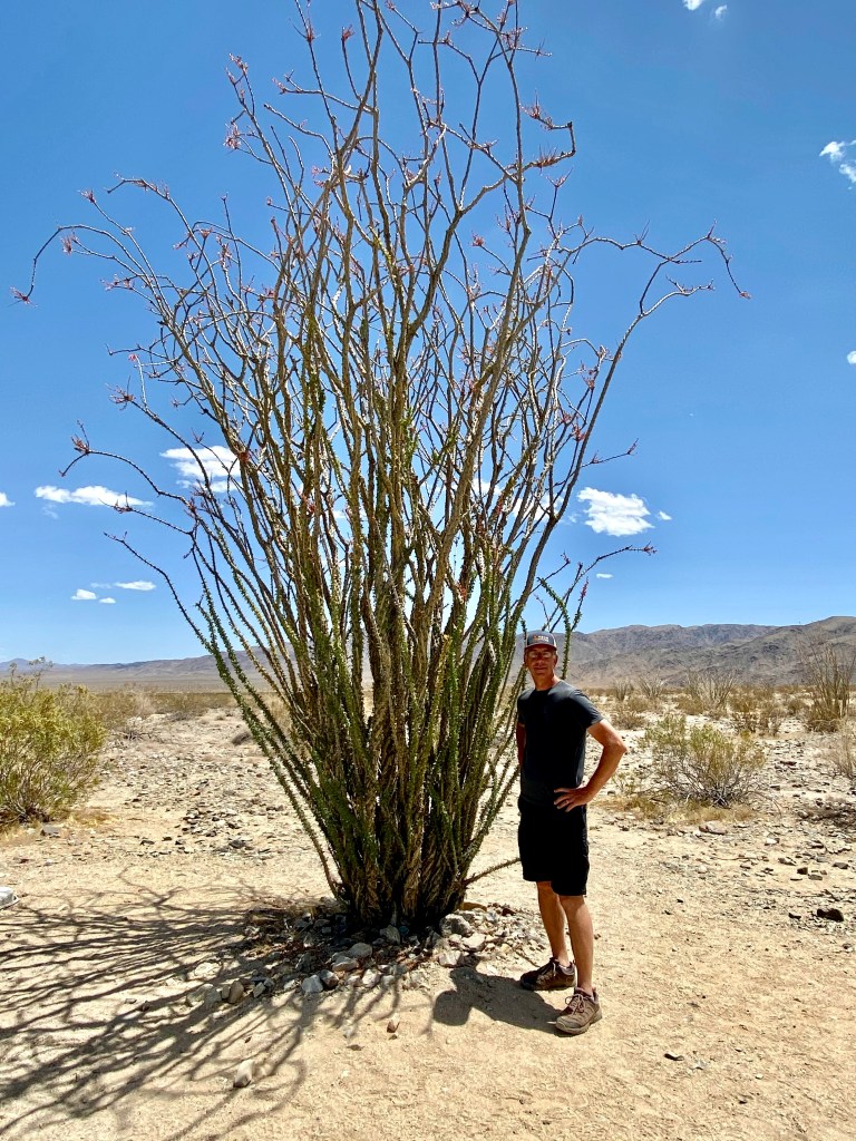
We continued to drive south on Pinto Basin Road till we reached a pullover near an Ocotillo Patch. The Ocotillo plant is another one of those interesting desert plants. They can reach a height of 20 feet and live well over 100 years! At this parking lot, there were few people. We decided this would be the perfect place to pull out our chairs and enjoy lunch in the desert. Over lunch, we decided we would not continue south on Pinto Basin Road but instead make our way to Arch Rock.

As it was later in the day, the crowds within the park had picked up, and the Arch Rock Trailhead parking area was full. We had to make several laps in the parking lot before a spot became available. The hike is a 1.2-mile out and back trail. When we reached Arched Rock there was a line of people trying to get a photo in front of the arch. It was so crowded I turned around and left without a picture. Maybe I should have stayed longer, but this was clearly one of those Instagram photo locations. People were scrambling the rocks trying to get the perfect picture and pose. It was not a pleasant experience so I had to leave.
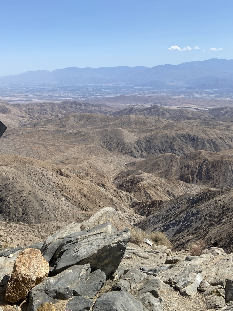
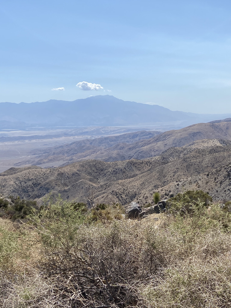
Our final stops would be Key’s View and then Cap Rock before we exited from the West Entrance. Key’s View provides an overlook, and way out in the distance lies Coachella Valley and Palm Springs. Cap Rock was a short loop trail around another boulder heave, a great place to climb and explore the rock formations.

We covered a lot of ground over a day and a half. I would say we had a very successful visit.
It was time to head into town and enjoy our final landmark, the Joshua Tree Saloon. To our dismay, the place was packed, so we decided to head back to Twentynine Palms, where we ate at Edchada’s. This was an excellent choice. I ordered the usual: chips & salsa and enchiladas, and of course a margarita! My only regret, I did not order the 32-oz margarita, which I noticed after the fact when a waiter walked past me with several on a tray.
Given the welcome received at the RV Park, we still enjoyed our time at the RV Park and its location to Joshua Tree National Park. It certainly was different than Utah. But that is why we took this trip, to see the great places the United States has to offer.
Next stop, Palm Springs for some rest and relaxation.
