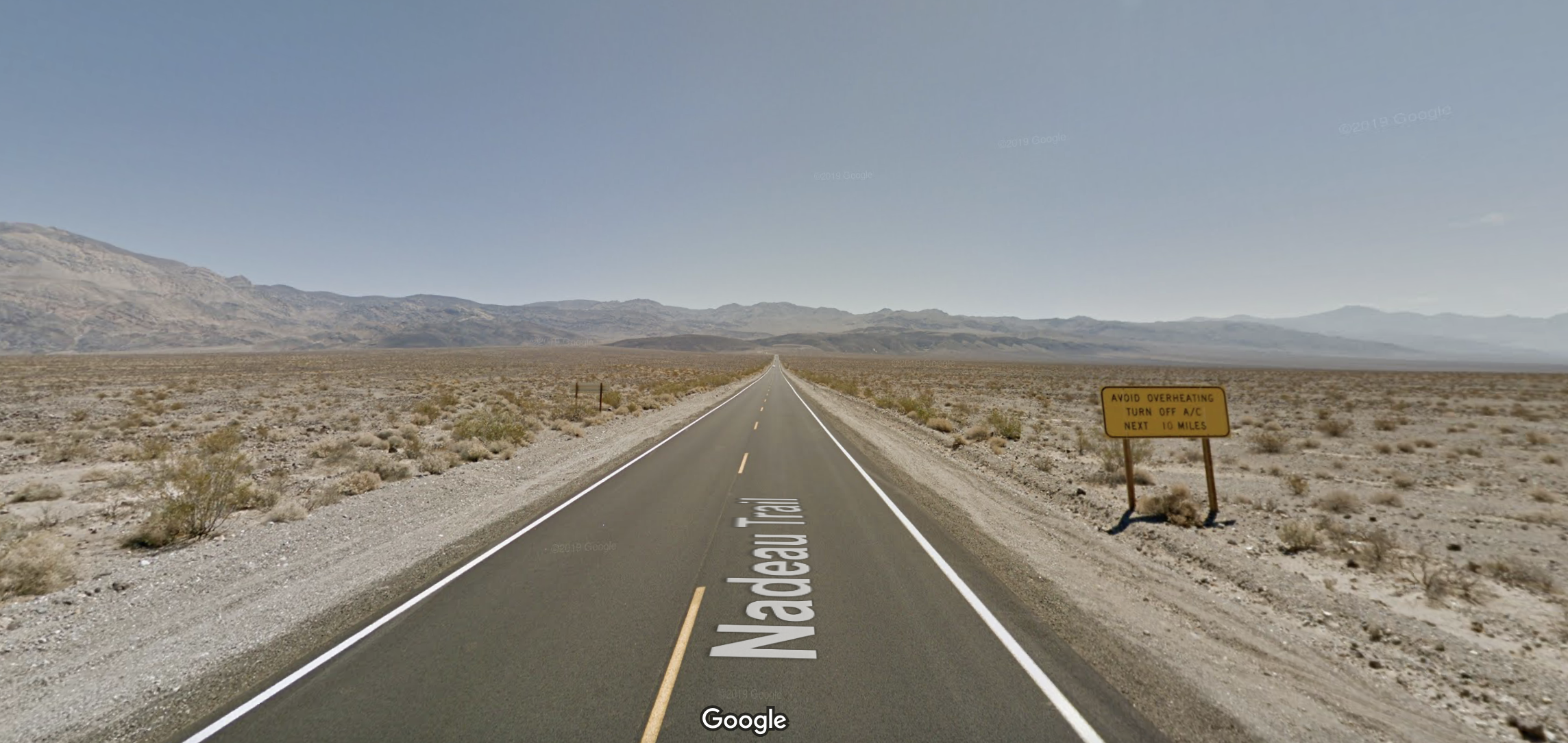
Using Lone Pine, CA, and the Boulder Creek RV Resort as our home base for the week, we would take a day trip to Death Valley National Park. It would take two hours to reach our first destination within the park, but it would be worth it. The drive to Death Valley from Lone Pine was insane. Highway 190 would take us through the most remote parts of the US we had seen.
As you travel on highway 190 you pass Father Crowley Overlook and Star Wars Canyon, aptly named as this is where fighter jets practice low altitude flight maneuvers. You begin your descent down a steep winding road into the Panamint Valley. As you pass through Panamint Springs, you will travel 5-miles over sand flats across the Valley floor before climbing again as you reach Towne Pass, an elevation of 4,956 feet. Once again, we began to descend, this time much longer and straighter, before reaching Stovepipe Wells Village. Both towns have a gas station, a small convenience store, a campground, and lodging. Both are pretty remote. But, if you need a place to stay or need gas, these are your options.

Highway 190 from Lone Pine to Death Valley was a crazy drive, in a good way. Before departing, I had no idea what to expect. The views as we descended into Panamint Valley. The drive across the sand flat while starring out in front of you at the climb to Towne Pass. They were all indescribable.
Depending on your route through the park, there are overnight options. Furnace Creek campground and the Oasis at Death Valley are located in the center of the park. Both were closed during our visit in May of 2021. The Oasis at Death Valley just completed a $100M renovation, and as we drove by it, it truly fits the definition of an Oasis in the desert. If I had a choice and the budget, this is where I would stay.
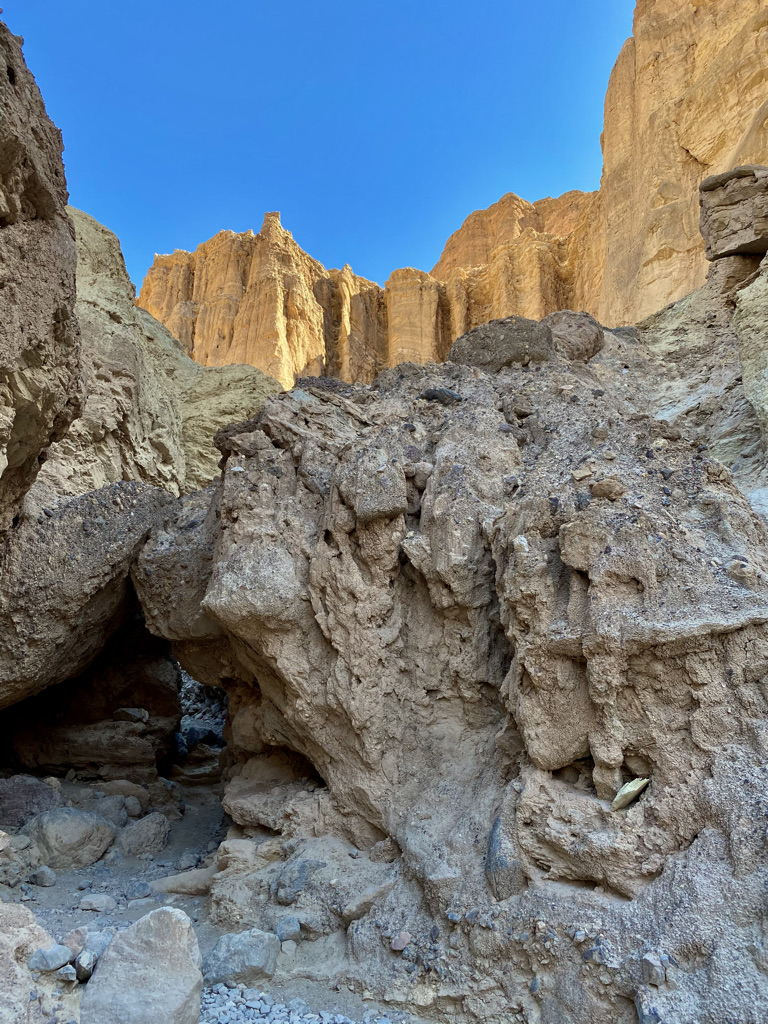
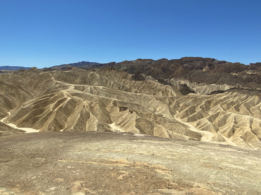
At 8:00 AM we arrived at an empty parking lot at the Golden Canyon Trailhead. It was 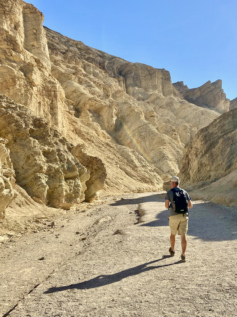 already getting hot, so we grabbed our water and hit the trail. We would hike Golden Canyon Trail to Red Cathedral, a 3.0-mile out and back trail. As we were the only ones on the trail, it was a little unsettling. It did not help that the trail winds through the sun-baked mounds of rock and dirt, worn over time by the sun, rain, and wind. I found myself wondering what might lie around each bend. It felt like I was in a science fiction movie.
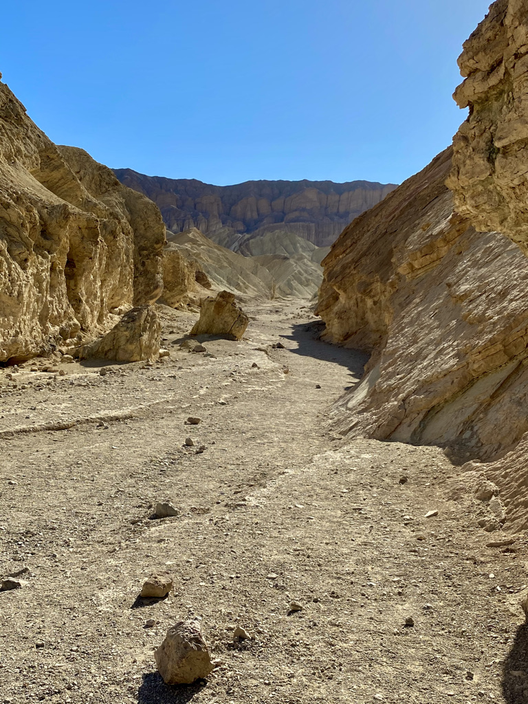

After making our way through a tight squeeze in the rocks, hoping no rattlesnake or scorpion were lying in wait, you approach the canyon walls known as the Red Cathedral and the end of the trail.
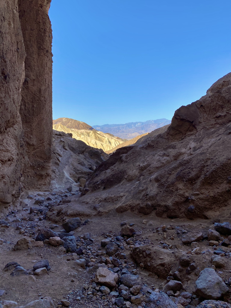
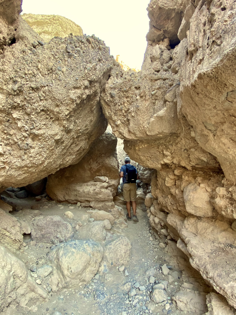
This was a great hike, not difficult at all, and a great introduction to Death Valley. Get here early to avoid the afternoon heat!
There are additional trail options off the Golden Canyon Trail. These trails interconnect, leading to Zabriskie Point. Make sure you have a downloadable or paper trail map if you attempt that hike. You don’t want to get lost out there!
Our next stop would be Dantes View, a 35-minute drive through the heart of Death Valley. As you make your way south along Furnace Creek Wash Road, you will see the old mining town of Ryan on your left, up in the hills. Before shutting down, a borate mineral called colemanite was mined at this location. Today, the mining town of Ryan is managed by the Death Valley Conservancy. Tours of Ryan and the mine are run by the Death Valley Conservancy. For details, click this hotlink. As you will read in the Park material and at the various sites, before becoming a National Park, Death Valley was known for mining. Before its financial demise, Harmony Borax Works processed minerals in Furnace Creek from 1883 to 1888.
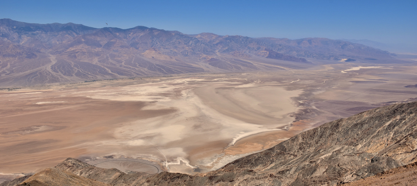
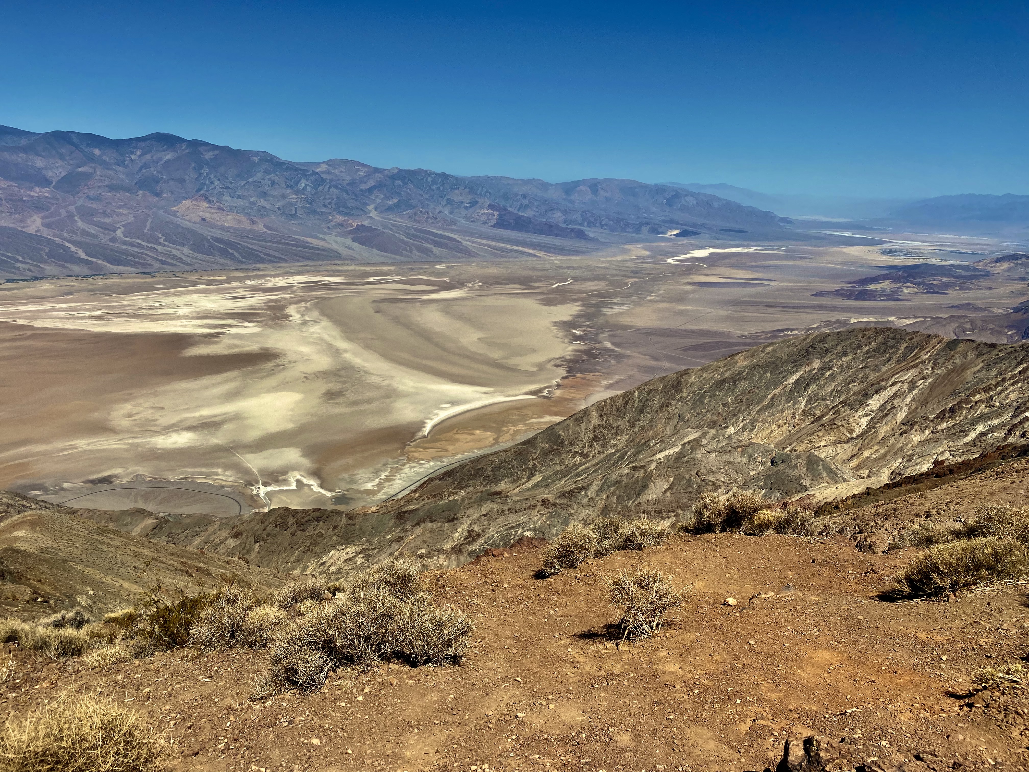
As we made our way through a valley, we began our climb before reaching the large parking lot for Dantes View, sitting at about 5,5476 feet above sea level. At the top of Dantes View, you have a stunning view of the Badwater Basin. This is an overlook, so you do not have to hike to take in the view. If you wish, Dantes View Trail is a rim hike from this location.
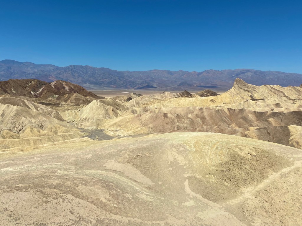
As we made our way to Badwater Basin, we stopped at Zabriskie Point for a different view of Death Valley from a lower elevation, about 820 feet. Zabriskie Point was named after Christian Zabriskie, who served as the VP/GM of the Pacific Coast Borax Company for 36 years which played a big part in the history of this area.
A short path with an uphill climb will lead to an overlook. As you make your way up the walkway, you see how the environment has impacted the landscape. Veins created over time by the wind, rain, and heat have dried and molded the landscape. In the distance, you can make out the saltwater basin. For the adventurous, you can take a trail that winds through this valley to Golden Canyon, where we began our day, as I mentioned earlier.
If you choose to hike from Zabriskie Point, this would be an out and back hike unless someone will be meeting you at the Golden Canyon Trailhead parking lot. I would not suggest doing any solo hikes in this park without notifying someone of your plans. Getting lost in this desert would be disastrous!
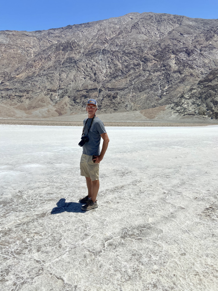
It was time to make our way to Badwater Basin, the lowest point in North America at 282 feet below sea level.
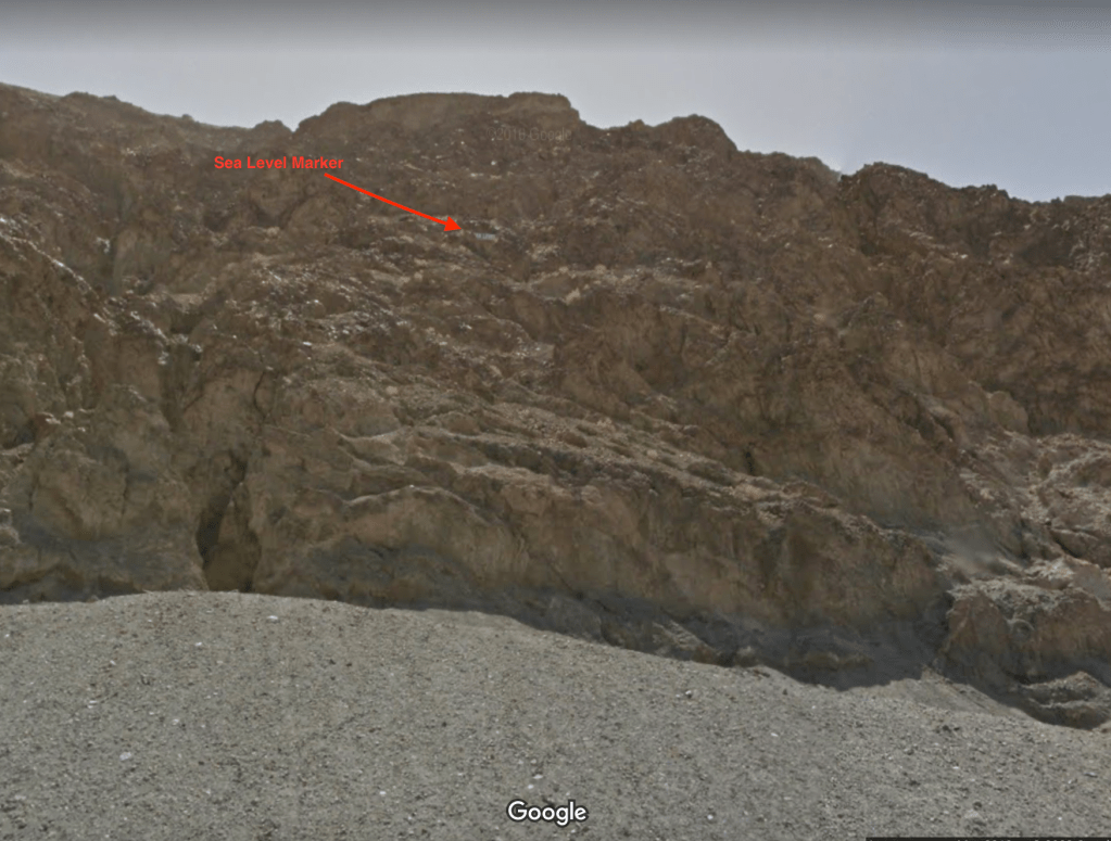
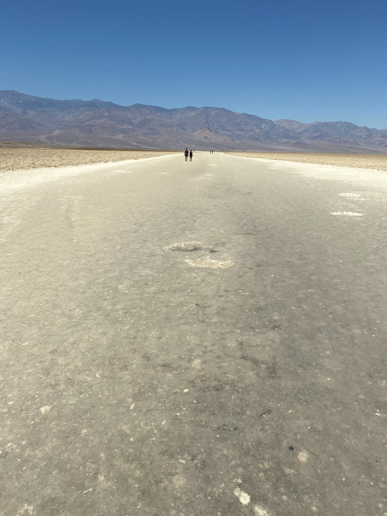
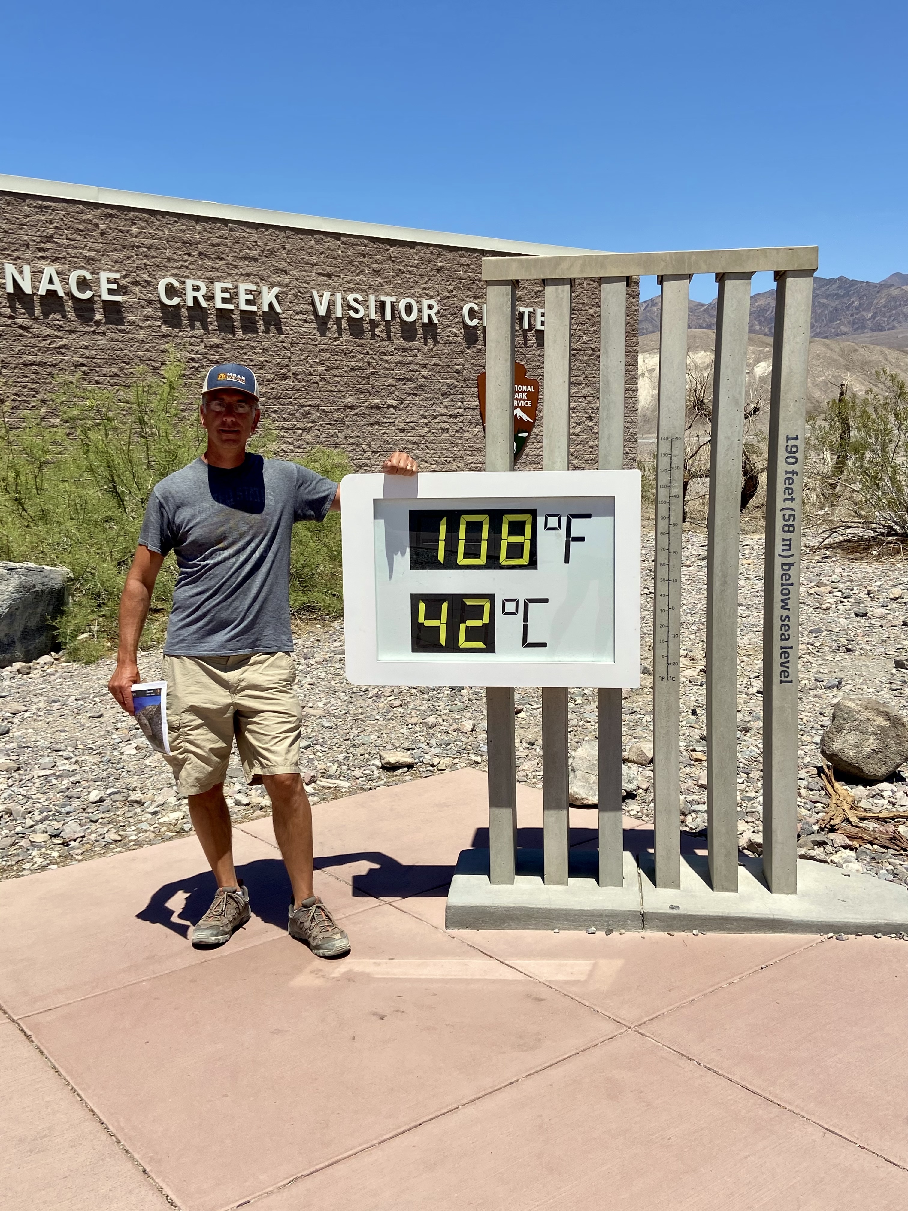
From the Badwater Basin parking lot, scan the cliff for a white painted marker in the rocks showing the location of Sea Level. If you wish, walk out onto the salt flats. There is a 1-mile out and back trail. It appears as if you can walk out as far as the eye can see. The temperature now reached 108 degrees, so we decided to go about 1,000 feet to where the trail narrowed. Here, there is no protection from the sun. That would be far enough for us.

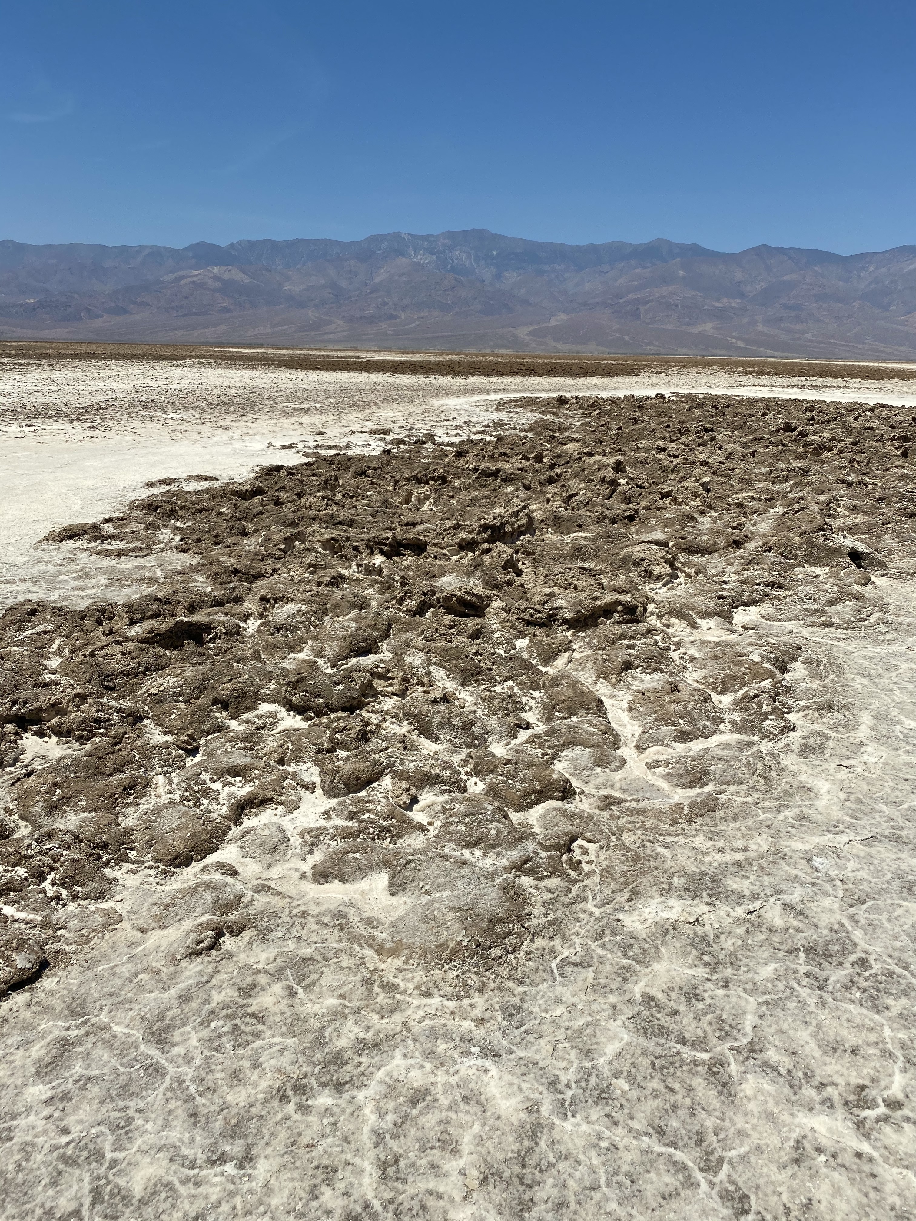
While visiting this park, please stay on the path! Do not disturb the salt flats or surroundings! Why do people feel they are free to do whatever they want? This is a National Park! Let’s preserve them.
For me, the highlight at Badwater Basin was standing at the lowest point in North America. And, from our campsite, we could see Mt Whitney, the highest mountain in the contiguous United States at 14,505 feet above sea level. That was a pretty neat experience. What a great day!
One can continue heading south from Badwater Basin for additional hiking. Sidewinder Canyon and the Ashford Mill are south of here, but it was too hot for any more hikes.
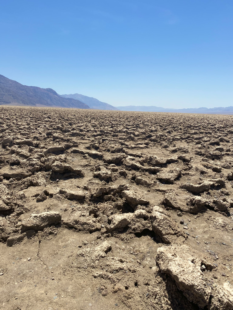
As we began to make our way out of Death Valley, we decided to take the 1.25-mile dirt road to Devil’s Golf Course for a unique perspective of Death Valley salt flats. Dried salt mounds litter the valley floor, as shown in the photos below.
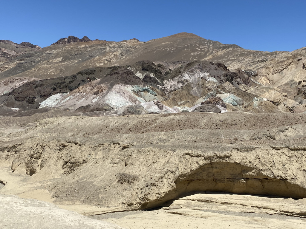
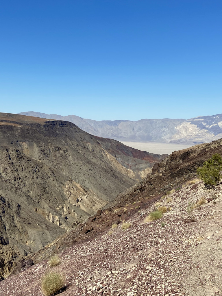
Our last stop in this area would be Artist Drive, a nine-mile one-way scenic drive past Artists Palette to take in the unique desert colors formed by volcanic deposits. For those Star War fans, parts of Star Wars Episode IV: A New Hope was filmed here. You can hike a 0.3-mile out and back trail through the formation for close-up pictures of the colors in the rocks.
Death Valley National Park is a big park covering a lot of distance. Several Must-See Locations highlighted in the National Parks Visitor Guide are quite a distance from one another. Because of this, we did not drive out to Ubehebe Creator or the Charcoal Kilns.
Fortunately, we came into the park from the west on highway 190. This took us past the Mesquite Flat Sand Dunes and Father Crowley Vista Point. We made brief stops at each as we made our way back to Lone Pine.
From Badwater Basin it is 76 miles to Father Crowley Vista Point! If you are not heading this way, I am not sure I would recommend driving this distance.
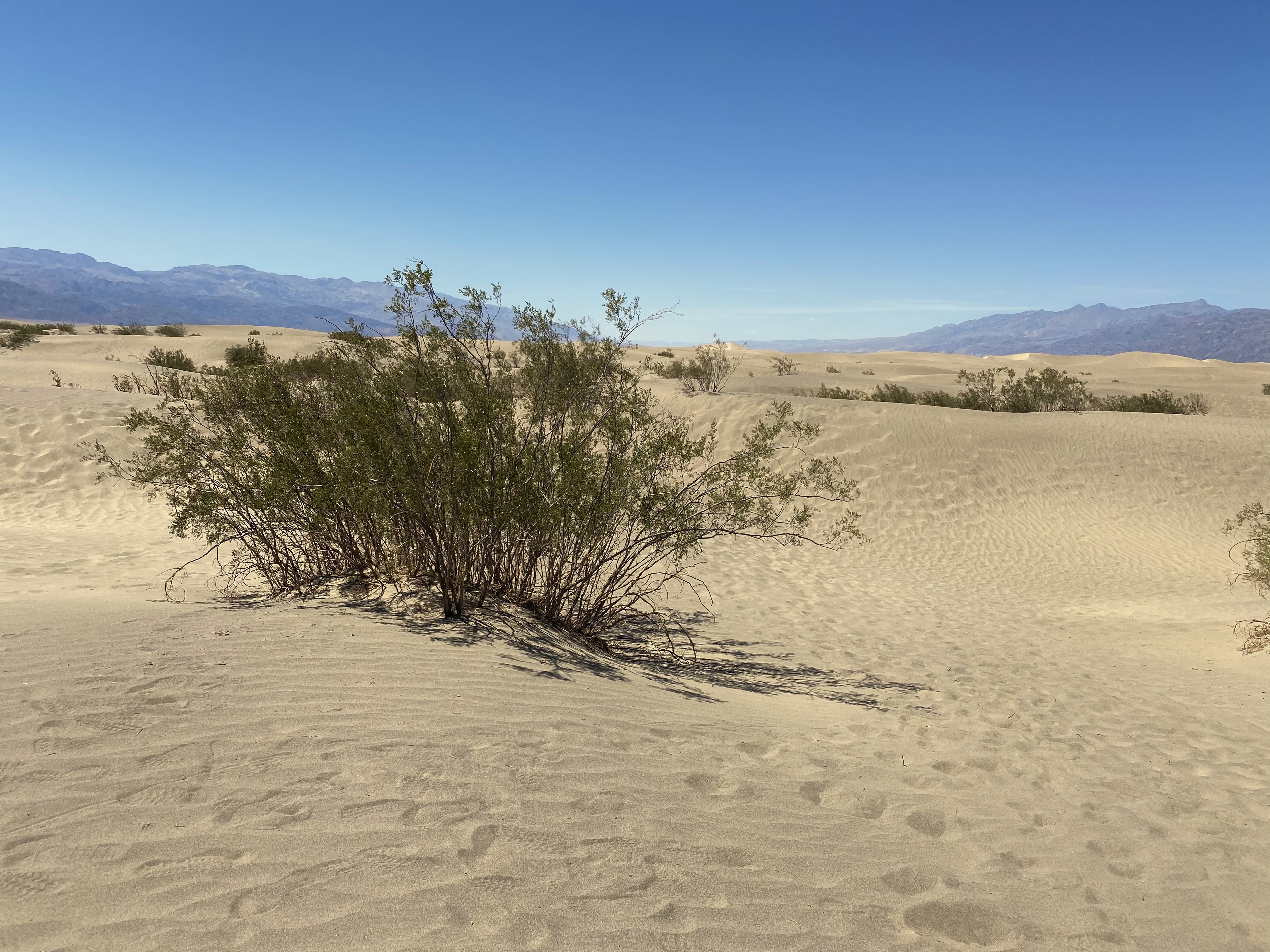
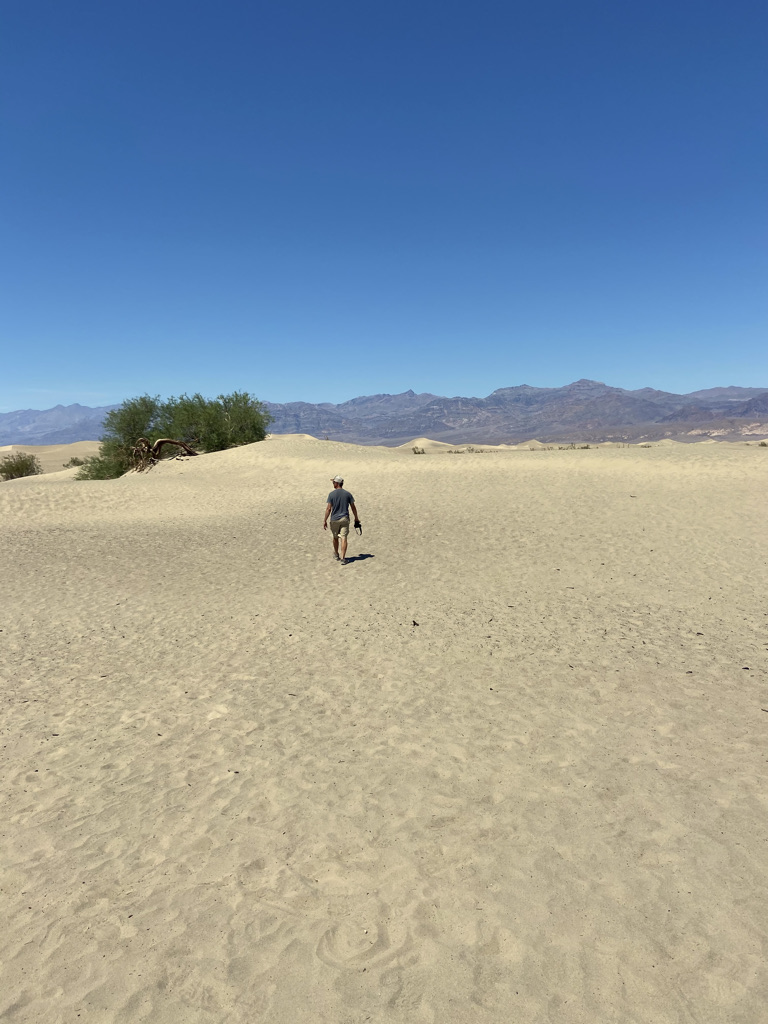
If time permits, the Mesquite Flat Sand Dunes might be worth the drive. It is a pretty unusual landscape. It is located 36 miles from Badwater Basin. You can hike in the dunes as far as you would like. It will be a workout! I wanted to experience this, so I took a short hike.
Two miles from this location is the Badwater Saloon in Stovepipe Wells. If you plan your day well, you can always visit the dunes then head to Stovepipe for lunch.
It would be a two-hour drive back to Lone Pine, so we made a quick stop in Stovepipe Wells for cold drinks before making our way through Panamint Valley. We did make one more stop in Panamint Springs for an ice cream milkshake.
Trip Highlights:
Great Hike: Golden Canyon to Red Cathderal
Best Overlook: Dantes View
Unique Park Perspective: Devils Golf Course
Favorite Experience: The drive on 190 from Lone Pine to Death Valley
Unexpected: Mesquite Flat Sand Dunes
It was a long day but definitely worth the time. I am not sure how else we could have made our travels easier based on the parks location. As far as I was concerned, the views on highway 190 from Lone Pine to Death Valley made it worth the effort!
