
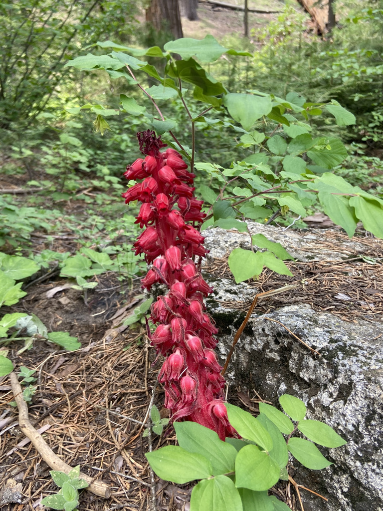
After a week in Lone Pine, CA, we made our way to Sequoia National Park. It was the drive north on Highway 65 where we began to appreciate the size of the agriculture industry in California. We passed miles and miles of orange groves and olive trees, an unusual site seeing how hot and dry it was.
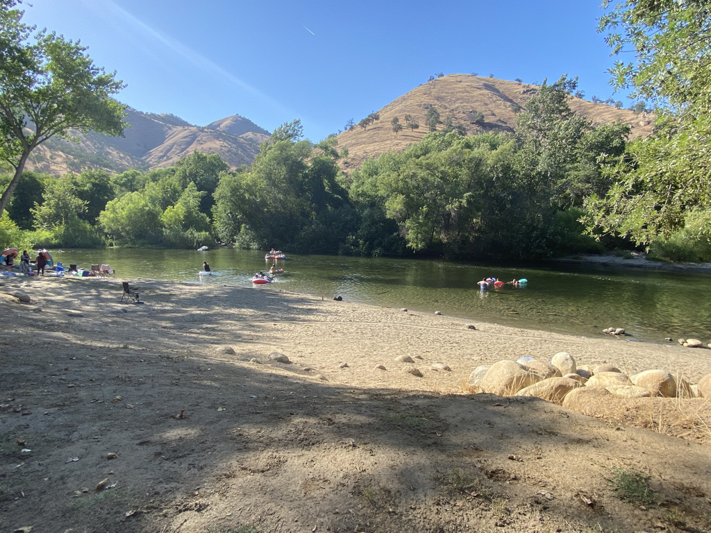
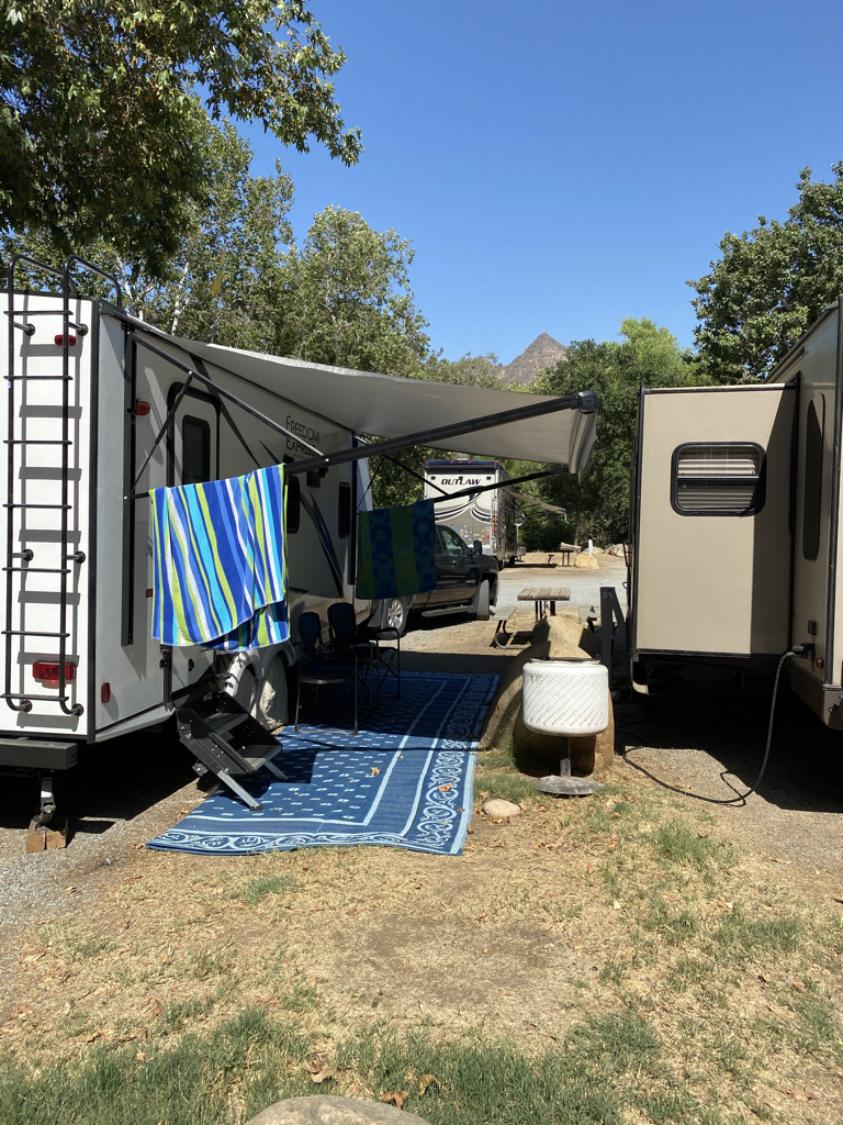
Based on my pre-trip planning, I looked for a campground close to Sequoia with full hookups and reliable cell coverage. There are not many options, so I chose the Sequoia Campground & Lodge along the Kaweah River. The campground was adequate. Quiet during the week and busy during the weekend, as I had read and expected. It also has a pool, and you can swim in the river that runs along the edge of the property. With temperatures exceeding 100 degrees, we would surely take advantage of this.
The campground is only 28 miles to General Sherman Tree Parking Lot. I thought that was pretty good, given the options. However, I did not anticipate the elevation climb and hairpin turns that would take us through the park on Generals Highway. You climb 6,021 feet over 28 miles at a posted speed limit of 30 mph for a good reason! It would take over an hour to cover those 28 miles, and my nerves were shot by the time we reached a more comfortable drive. Given the drive, I did not want to make too many trips into the Park over our five-night stay.
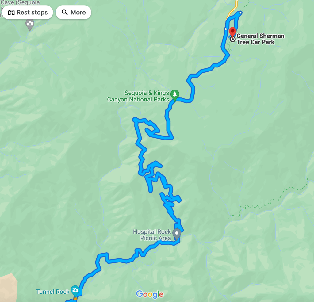
If you plan to visit Sequoia National Park, consider the desired entrance. There are two options, CA 198 through Three Rivers, where we stayed, or CA 180 via Squaw Valley. The drive time on CA 180 from the Big Stump Entrance to General Shermans Tree parking is about 30 miles and will take an hour. The advantage of this drive is you will not have to deal with the twists and turns and steep drop-offs provided on CA 198. Your nerves will thank you.
We would opt to exit via CA 180 on our second day in Sequoia National Park, as we had already driven to Kings Canyon, the northern section of this dual national park. On this route, we passed the Sequoia RV Park in Squaw Valley. I took note of the campground as this might be a better option should we return for another visit.
Regardless of your location, it takes a long time to reach the Sequoia Trees. Due to the unexpected drive, we only made two trips into Sequoia National Park. Our remaining time in Three Rivers was spent enjoying the pool at the campground. Be sure you have a full tank of gas before heading into the park as there is no gas available in the park. And yes, regardless of your entrance, the drive is worth it.
Due to the park size and our location, our first day would be spent visiting sites in the General Sherman Tree area. On our second day, we would visit sites near General Grant Tree and exit via CA 180.
Interesting facts about the Sequoia Tree:
- Sequoias can live up to 3,000 years
- Chemicals in the wood and bark repel most insects and fungi
- The thick bark, up to 3 feet thick, insulates them from most fire
- Sequoias have a shallow root system, with no taproot
- The cause of death is often the result of soil moisture, root damage, or wind which, due to their height, cause them to fall over.
- Sequoias grow at an elevation between 5,000-7,000 feet
- Sequoia’s cones retain their seeds for close to 20 years. When fires burn through this area, they dry the old cones out and they open up, dropping their seeds. Bare soil is needed to germinate the seed.
- Redwoods might grow higher, live longer or have larger diameters, but Sequoia trees are the largest living tree on earth, in total volume.
- Sequoia’s branches can reach a diameter of up to 8 feet
To learn more about some of the largest trees in the world, check out this hyperlink.
Day 1:
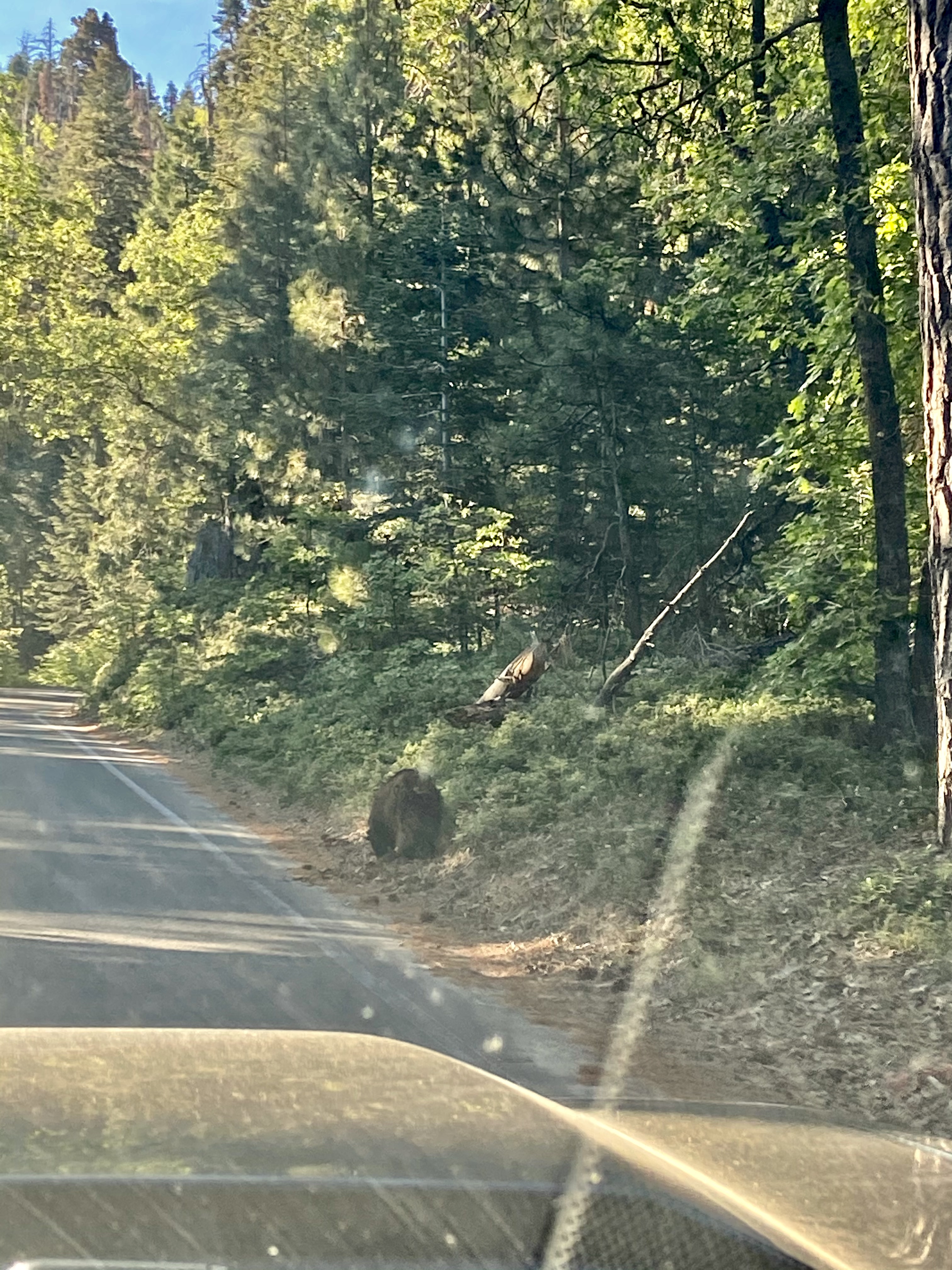
We drove directly to the General Sherman Tree Parking area. As we made our way up to General Shermans Highway, we came across a bear along the side of the road foraging for food. It did not give us any attention. My wife was shocked and a little frightened. I suggested she roll down the window for a picture as we drove by, but she would not, so all we have is this terrible picture.
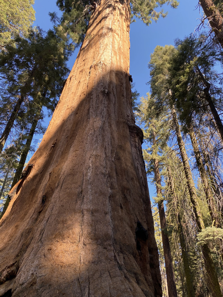
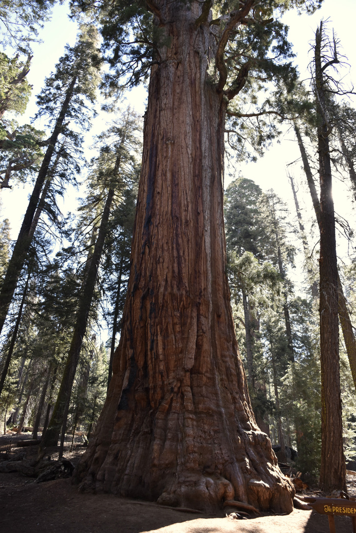
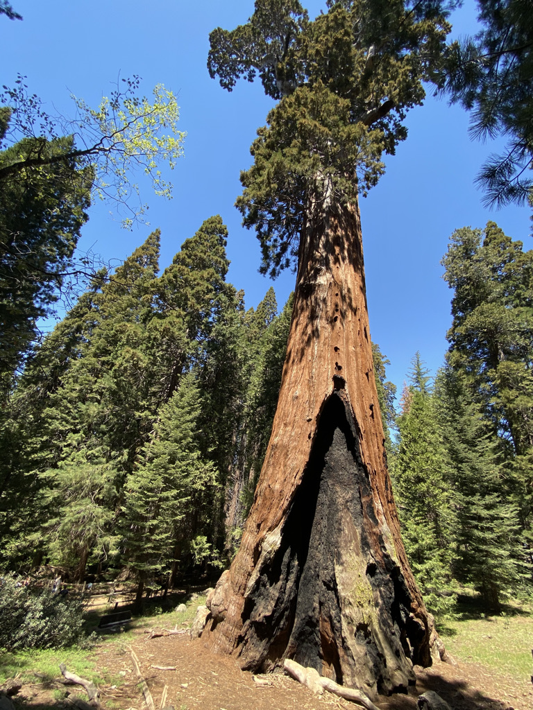
We hiked the General Sherman Tree Trail. An easy trail, with an initial steep descent, loops through the forest leading to General Sherman Tree, one of the most iconic Sequoias in the park. The General Sherman Tree is the world’s largest tree, measured by volume. It is 275 feet tall and is over 36 feet in diameter at the base. Very impressive!
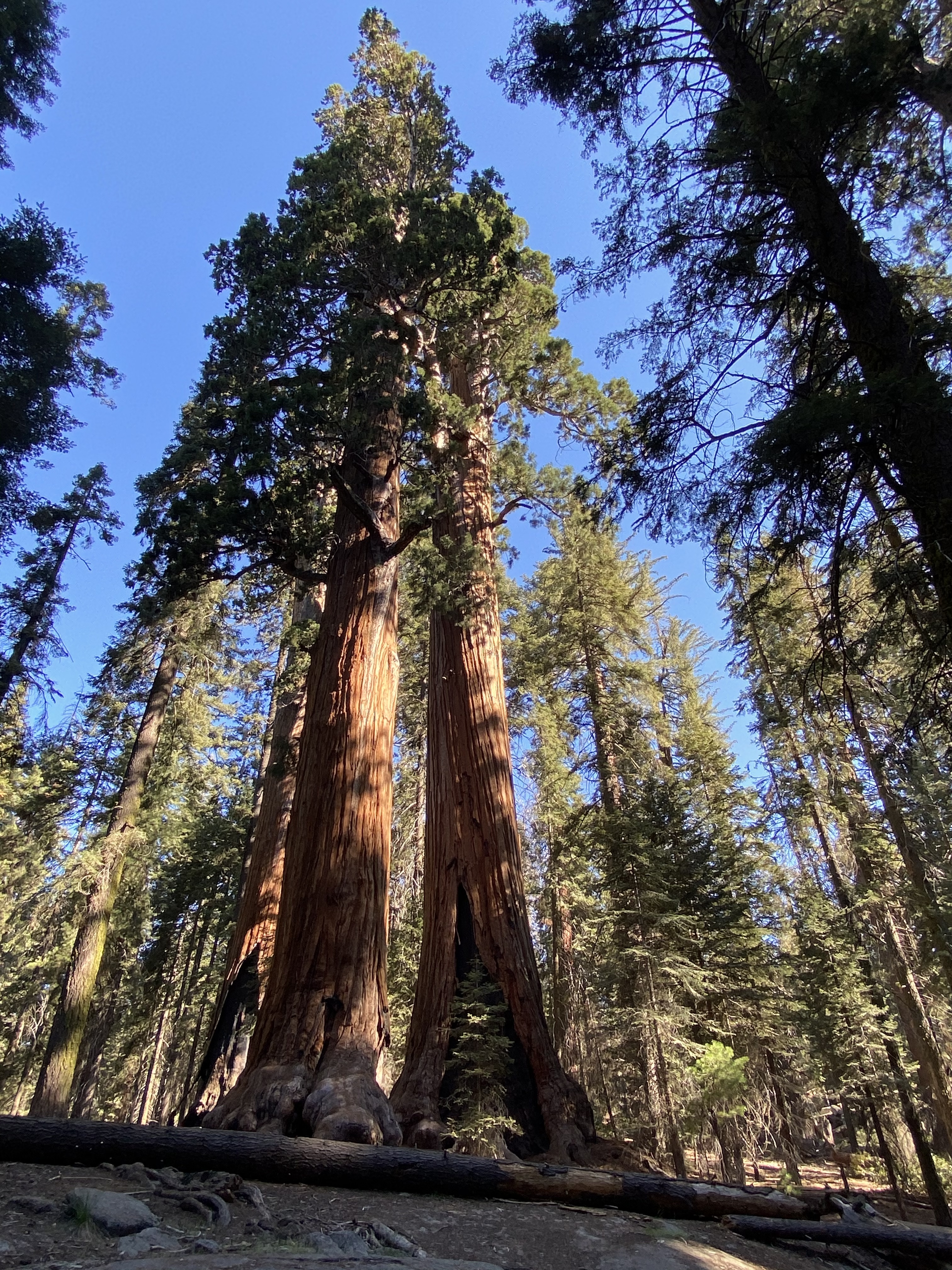
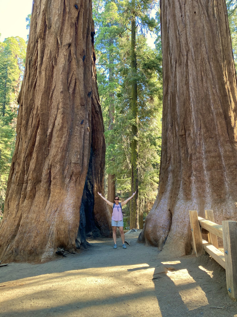
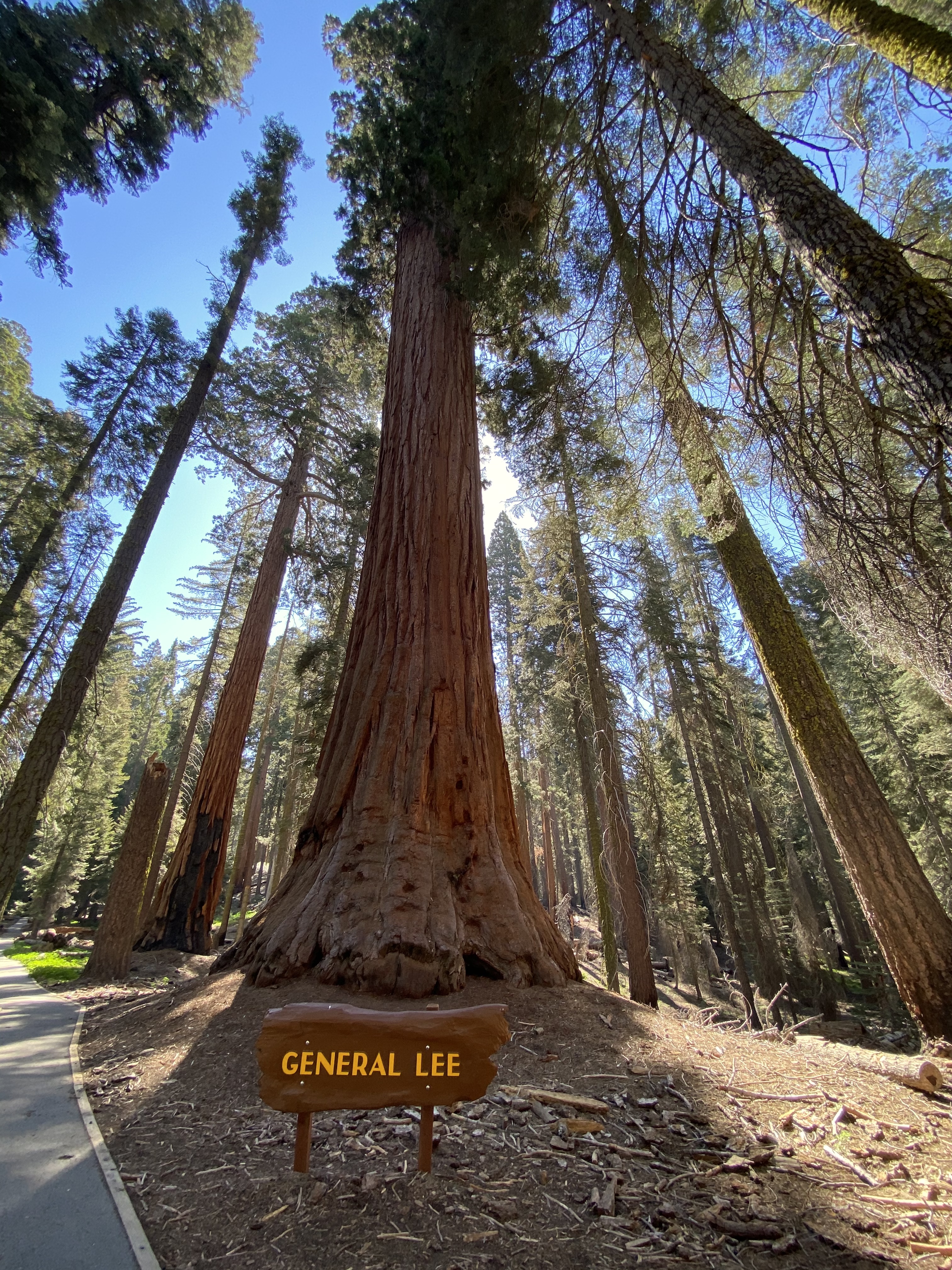
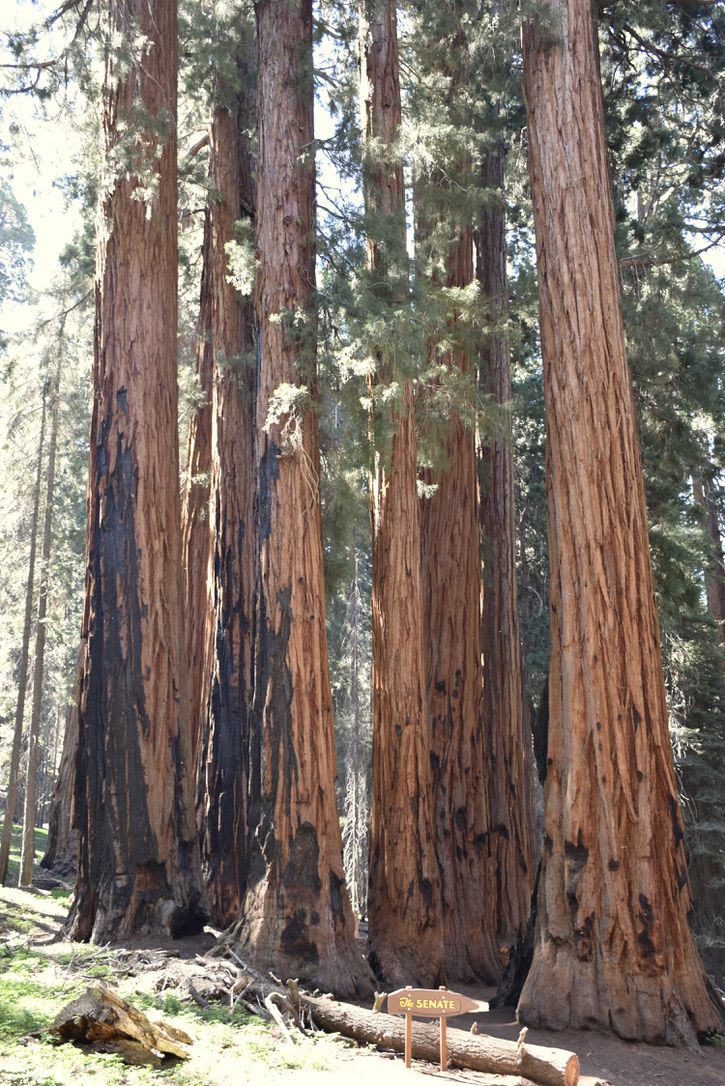
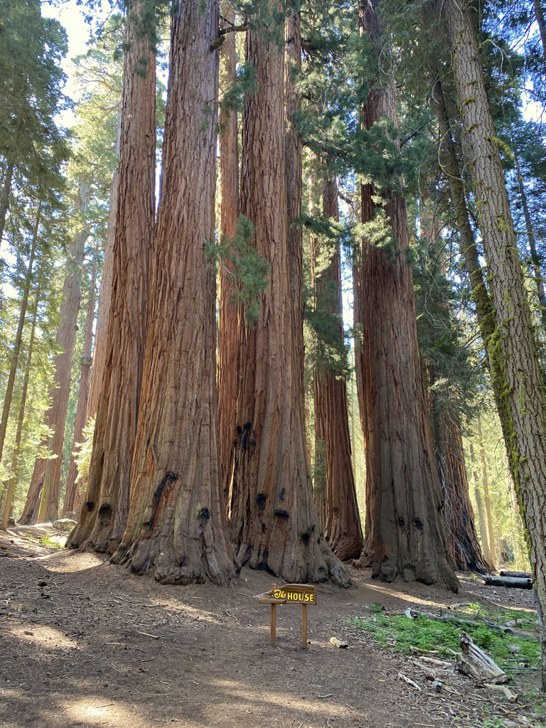
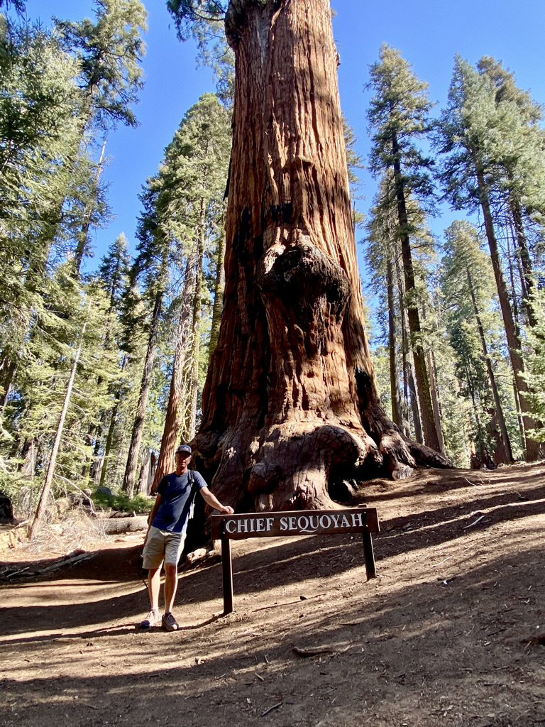
From here, you can take the Congress Trail, a 2-mile loop trail that takes you through the forest where you will find many sequoias. Named Sequoias and groves along this trail include General Lee, The Senate, The House, Chief Sequoyah, and McKinley. I would highly recommend this trail. I would say it was my favorite hike in the park.
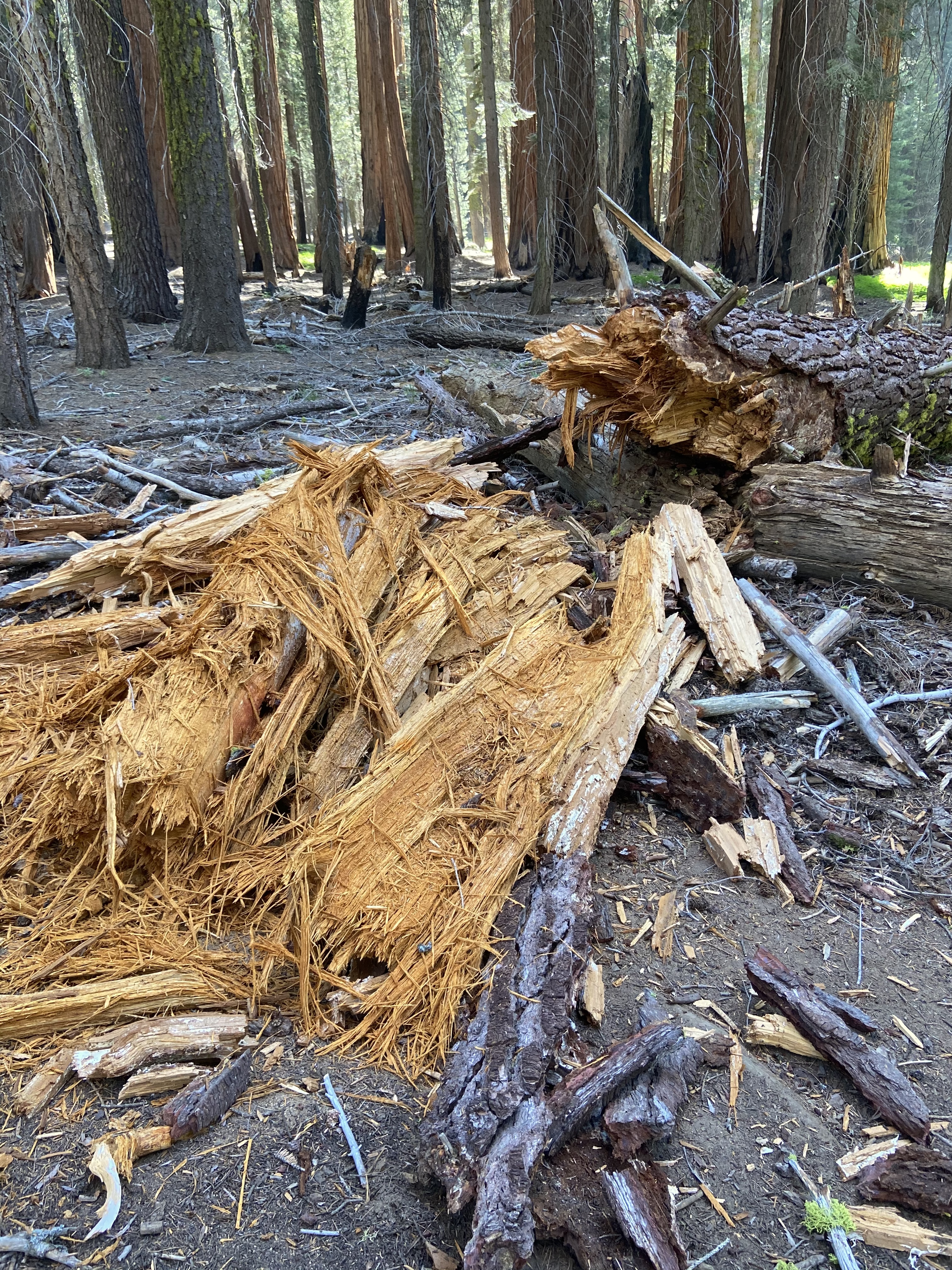
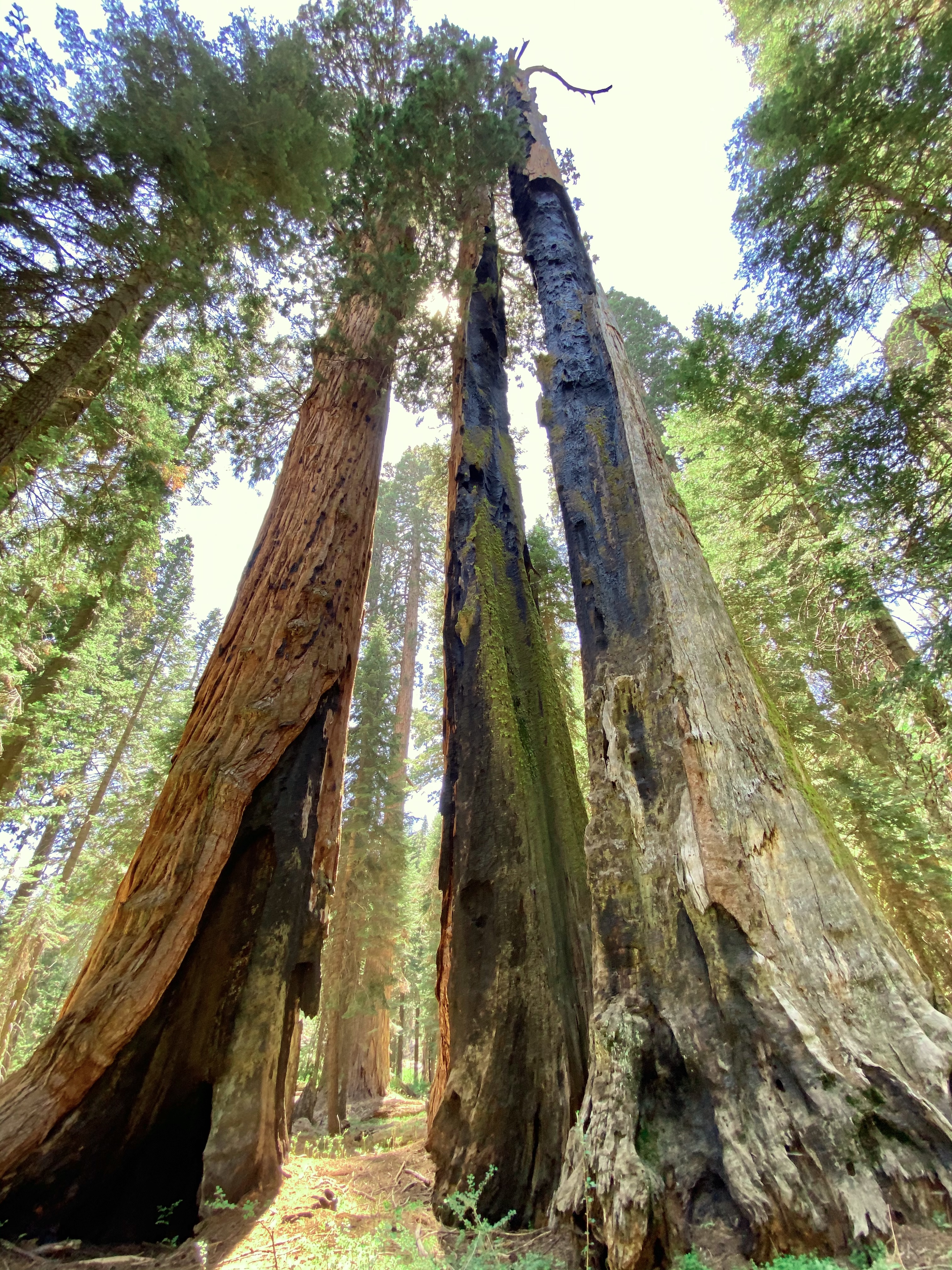
We spent close to 3 hours exploring this area at a very casual pace. It was during this hike we heard and observed a treetop fall not far from where we were standing near the General Lee Tree. It was not a Sequoia, but it was large, loud, impressive, and scary.


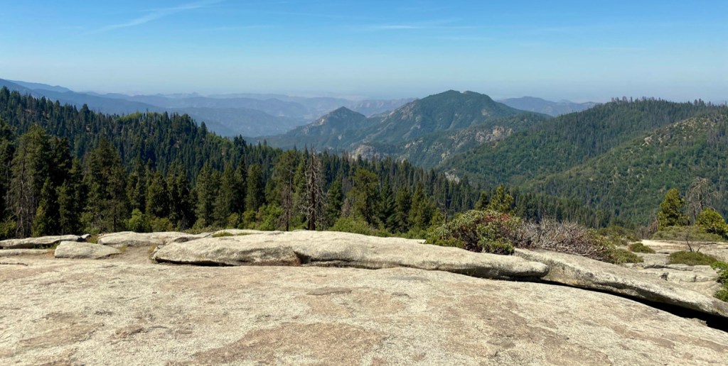
The next stop would be the Giant Forest Museum. Across from the Museum sits Sentinel Tree. We would park and explore several hikes from this location. The first would be Beatle Rock, a 0.5-mile hike. The overlook from this rock provides a beautiful view of the San Joaquin Valley but is often hampered by the California fog. On this day we had a pretty good view.
We continued to the Big Tree Trail, a 1.3-mile loop around a meadow with Sequoias lining the edge. All the right conditions for Sequoias to grow, the right amount of sunlight, soil minerals, and moisture. Seeing the colorful hue of the Sequoia bark from across the meadow is a beautiful sight.

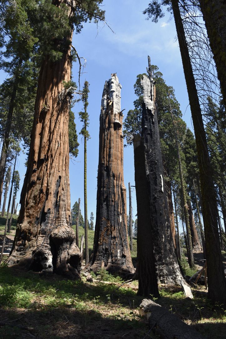
There is evidence of fire scars on many of the Sequoias. These are the result of past forest fires. Many of the trees survive, some do not. It is a bizarre sight and a true testament to the durability of this tree.
We ended our day at the Crescent Meadow Loop Trail. As we made our way to the trailhead we would pass by Tunnel Log.
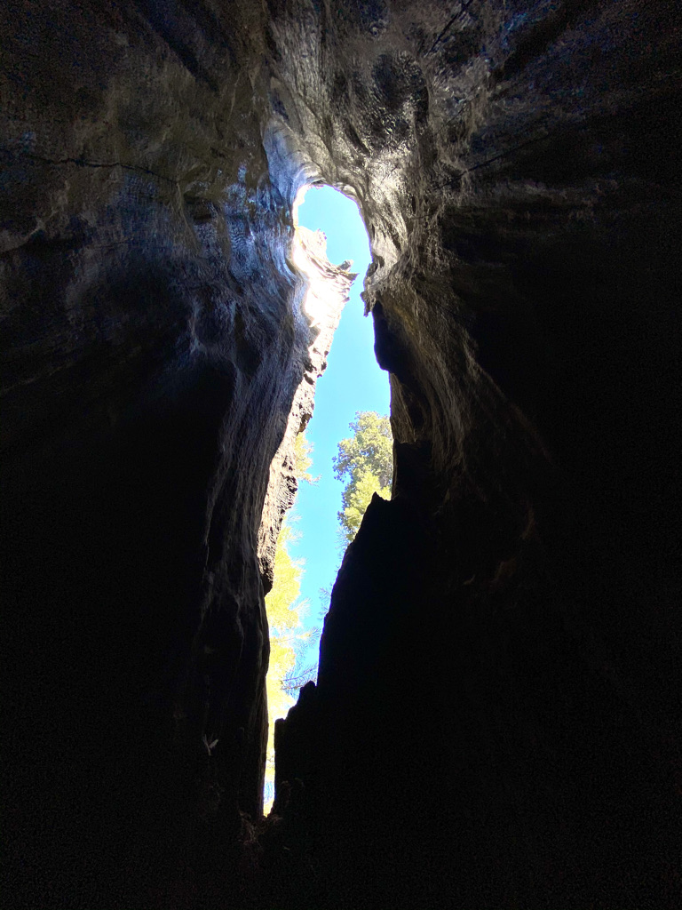
Tunnel Log is a Sequoia that fell across the road in 1937. Instead of removing it, a tunnel was created so visitors can travel through it. Today, it is a popular destination for pictures. Do not confuse this location with the famous tunnel tree you might be thinking of, the one you have seen in pictures where you drive through the base of the tree. That one is in Yosemite. Oh, one more thing, that tree fell in 1969 and no longer exists, sorry.
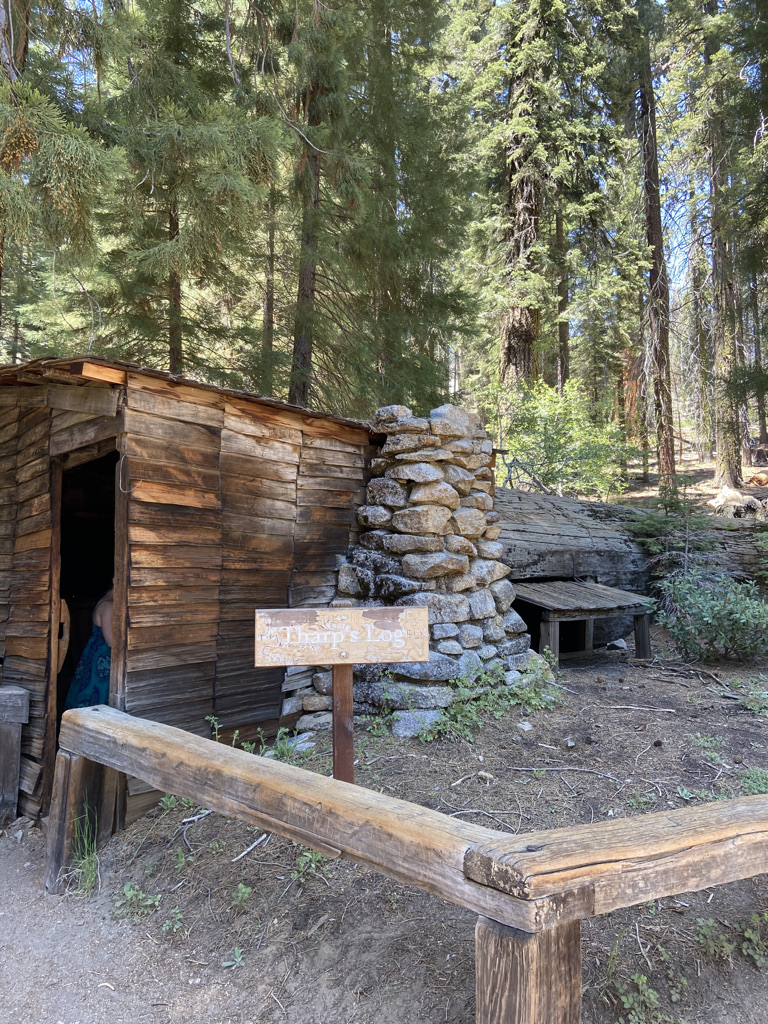
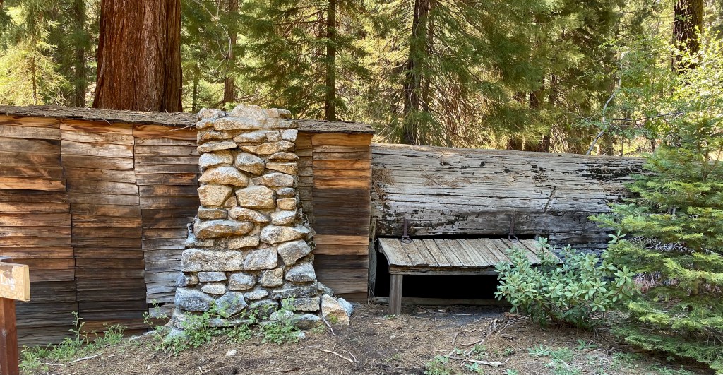
From the Crescent Meadow Parking Lot, we hiked the Crescent Meadow Loop Trail to Tharp’s Log, then to Chimney Tree. From there we dropped down past the Cleveland Tree and then back to the parking lot.
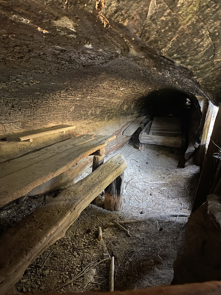
Tharp’s Log was an interesting site. Built as a cabin in 1861 from a fallen Sequoia tree, Hale Tharp lived here, and John Muir stopped here in 1875. Certainly a unique site in the middle of the park. Just try to imagine what life must have been like living in this log.
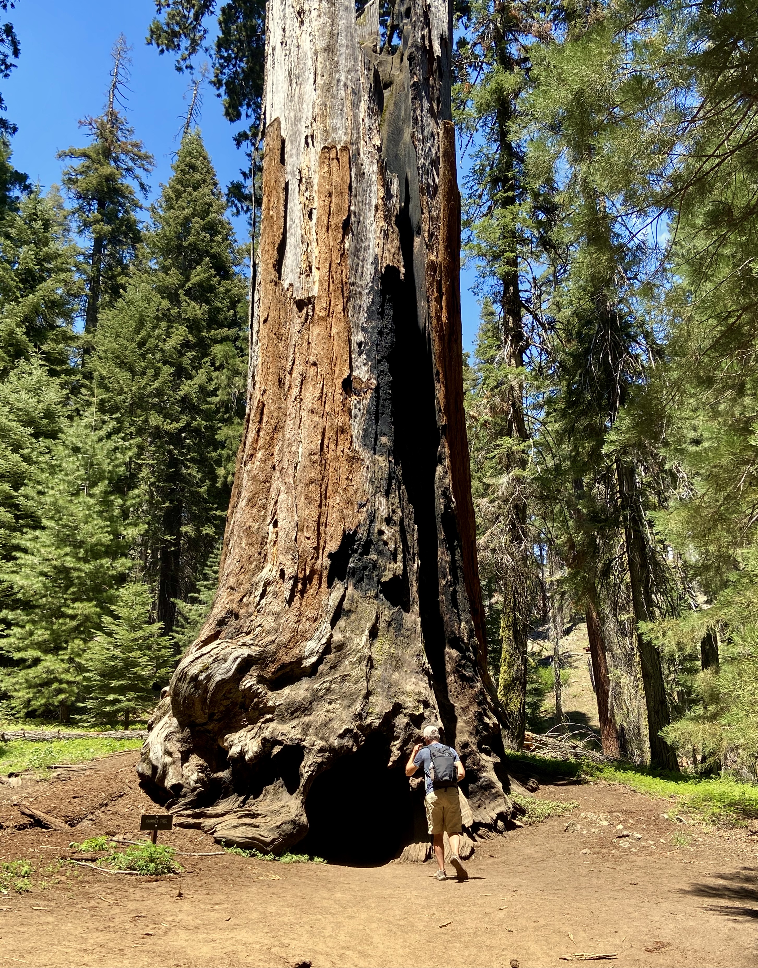
Chimney Tree is a casualty of a 1914 forest fire. The trunk of the Sequoia is hollowed out. You can climb into it and take a peek out the top.
The one-stop we did not make and should have, was Moro Rock. We would pass the road leading to the trailhead but skipped it as it was getting late. From YouTube videos I have seen after our visit, this looks like a must-do hike, and I am sorry we missed.
Day 2
With more to see in the park, we would venture back up Generals Highway for one final day in the park. It would take two hours to reach Buena Vista Peak Trailhead, 48 miles from the campground. We hiked the 2-mile out and back trail alone in the morning silence, hoping we would cross paths with any local bears.
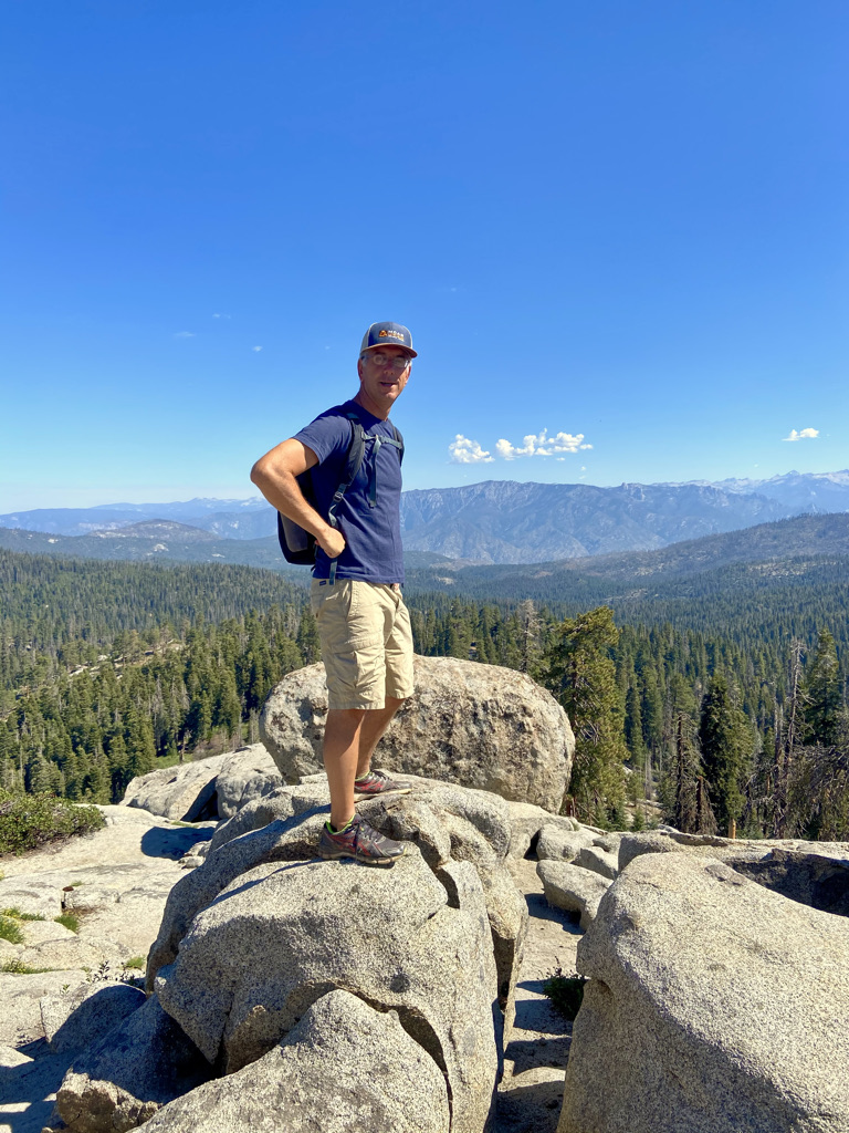
This was one of the more challenging trails we hiked. At the Buena Vista Peak, we enjoyed views of the Redwood Canyon, Sierra Crest summits, and Kings Canyon high country.
After completing our hike, we stopped at the Kings Canyon Overlook just up the road from the trailhead parking lot.
The next stop would be the Visitor Center to ask about a route back to camp. With our new route planned based on the Park Ranger’s suggestion, we headed to General Grant Grove.
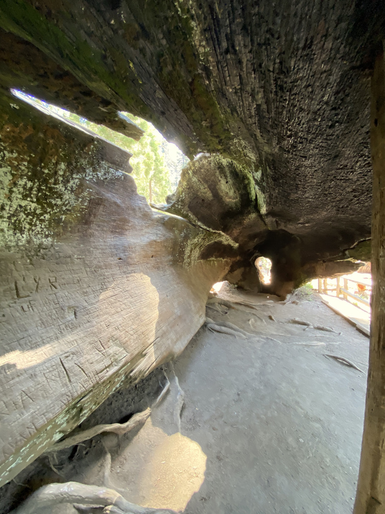
General Grant Grove contains a 0.7-mile loop trail and is the location of General Grant Tree, the second-largest tree in the world. The Fallen Monarch tree is located along this trail as well. This Sequoia Tree is hollowed out and one can walk through the length of it. It is a popular stop for pictures.
Our final hike would be the North Grove Loop Trail. The parking lot in the General Grant Grove area is very obvious. See the picture below for parking and trailhead.
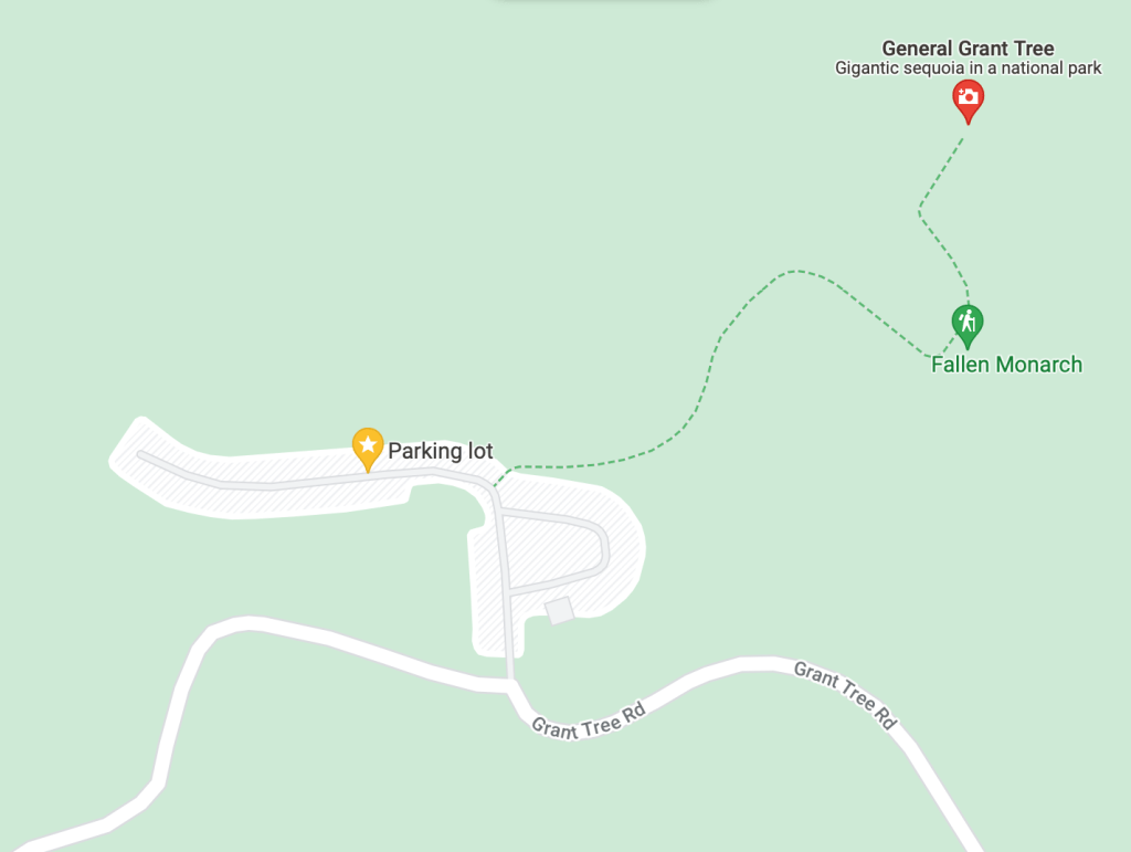
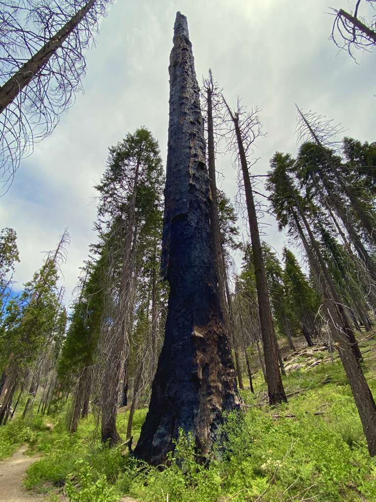
North Grove Loop Trail is a 2-mile loop trail with a long uphill climb at the end. If you want to get away from the crowds, this is the hike for you. We saw no one the entire hike, which made it a little eerie at times. There was plenty of burnt Sequoias along this trail, evidence of past forest fires.
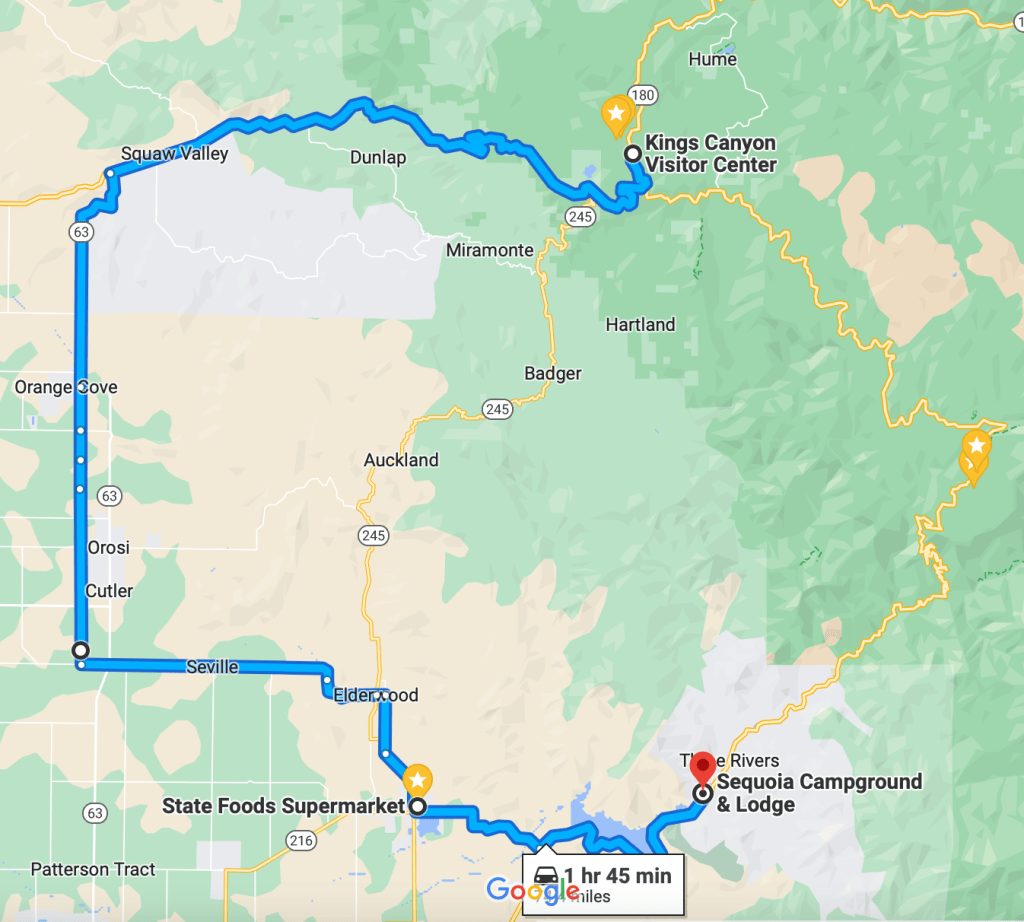
We would not return to the campground the way we came. Instead, we would take highway 180 to Squaw Valley, then 63 south to 201 to 245, and 216 as we made our way back to Three Rivers.
Additional Things to do near Three Rivers:
- Slick Rock Recreation Area
- Kaweah Recreation Area – 80 campsites, no hookups. Amenities include flush toilets, showers, and a dump station.
Dining Options near Three Rivers:
There are a few restaurants in the area. We ordered pizza one evening from Pizza Factory. It had good reviews and I agree, the pizza was good but in my opinion, a little pricy. Then again, we are in California, and based on the location, I can understand.
We noticed a food truck called Quesadilla Gorilla and two coffee shops, Sage Roots and Sequoia Coffee. All three have great reviews on Google but we never made it to any of these so check them out and let me know what you think.
